Skip to content

Long-distance trail

Eifelsteig

About 313 km hiking trail from Aachen to Trier through the Eifel, in 15 stages.

Stages
15
Total distance
about 313 km

Stages

Start Finish

Kornelimünster → Roetgen

Stage 1

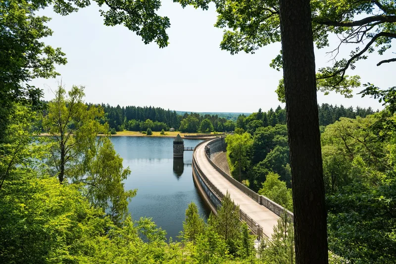
Eifelsteig stage 01 starts in Aachen-Kornelimünster and ends in Roetgen. The historic Korneliusmarkt in Kornelimünster, a place with a distinctive architectural character, marks the beginning of this hike. The route first passes the stone Itertal Viaduct, a former railway bridge that now serves as part of the Vennbahn Cycle Route. It then climbs up to the first Eifel ridge. The trail runs through wooded areas, whose fresh air intensifies the nature experience. A striking landscape feature is the Struffelt Heide raised bog. This area, of ecological importance, serves as a large water reservoir. Specially built wooden boardwalks ensure safe passage through the nature reserve and provide extensive views of the characteristic vegetation of grasses, birches, and heather. Further on, the Dreilägerbach Dam shapes the landscape. Its smooth water surface leads into the next section. A viewing platform located above the lake offers a place to rest and opens up wide views over the region. The presence of water in this Eifel region is a recurring element of the landscape. A subsequent steep descent into the valley is followed by a steady climb back up. The long-distance view here reveals the destination of the stage: Roetgen.

14.1 km approx. 4:15 h Point-to-point Hiking
View details
Ascent
327 m
Descent
136 m
Highest point
458 m
Lowest point
225 m
Elevation profile
200 m 400 m 600 m
7.3 km 9.8 km 0 km 14 km

Elevation profile calculated by Fairvisit from satellite elevation data. Ascent and descent usually differ by up to about 10 %, more on steep terrain.
Roetgen → Monschau

Stage 2

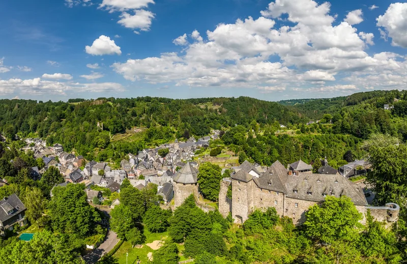
The second stage of the Eifelsteig starts in Roetgen and leads through a fascinating border region. The hiking route crosses the Belgian track of the former Vennbahn before entering a German exclave that is completely surrounded by Belgium. The constant change between the national territories is reflected in the adapted Eifelsteig marking, while the local population has grown accustomed to this cross-border reality. The trail then passes the historical remains of the Reinartzhöfe. It then continues through the High Fens, a vast raised bog and important water reservoir. This primeval landscape contains crosses marking fateful events. The nature-friendly yet highly fire-prone environment requires a straight route in some sections. The Eifel Viewpoint "Steling" represents the highest point of the Eifelsteig and offers sweeping panoramic views over the Eifel landscape. A place to rest is provided by Kaiser-Karls-Bettstatt, whose legend tells of Emperor Charles's stay. The stage destination is the cloth-making town of Monschau with its historic old town and characteristic half-timbered houses. Here, a variety of local and culinary offerings, including the Monschauer Dütchen, a mustard mill, and a coffee roastery, invite visitors to linger. Monschau's unique atmosphere rounds off the hiking experience.

17.0 km approx. 5:15 h Point-to-point Hiking
View details
Ascent
334 m
Descent
343 m
Highest point
661 m
Lowest point
386 m
Elevation profile
200 m 400 m 600 m
11 km 0 km 17 km

Elevation profile calculated by Fairvisit from satellite elevation data. Ascent and descent usually differ by up to about 10 %, more on steep terrain.
Monschau → Einruhr

Stage 3

Eifelsteig stage 03 presents itself as a challenging hike that runs from Monschau to Einruhr on the Obersee and is classified as a long-distance as well as regional hiking trail. The route begins in Monschau, a town distinguished by its historic half-timbered houses, ornate doors, and the Rur, which runs through the valley. After leaving the town center, the trail leads to elevated positions, including the Eifel Viewpoint "Kierberg," which offers a final perspective on Monschau before the landscape transitions into wooded areas. The route is characterized by varied terrain, eventually leading to the Perlenbach Dam. Its waters accompany hikers along the shore. Further on, Monschau-Höfen is reached, where the Höfen National Park Gate provides informative insights into the region's flora, especially the wild daffodils of the Eifel. The village scene of Höfen is also shaped by its distinctive beech hedges, as tall as houses, which serve as a historically grown windbreak and represent a characteristic feature of the Monschau hedge country. The Eifelsteig continues with further ascents and descents, always accompanied by the course of the Rur, which winds through rocky forest sections. This stretch repeatedly offers views that compensate for the effort of the tour. Particularly noteworthy is the view from Perdsley, which in autumn offers an impressive display of fall colors in the canopy below. The view from Wolfshügel finally reveals the stage destination: Einruhr. In Einruhr, the Rur flows into the Obersee, bringing this challenging stage to an end.

24.3 km approx. 8:15 h Point-to-point Hiking
View details
Ascent
786 m
Descent
903 m
Highest point
550 m
Lowest point
279 m
Elevation profile
200 m 400 m 600 m
6.2 km 15 km 0 km 24 km

Elevation profile calculated by Fairvisit from satellite elevation data. Ascent and descent usually differ by up to about 10 %, more on steep terrain.

Einruhr → Schleiden-Gemünd

Stage 4

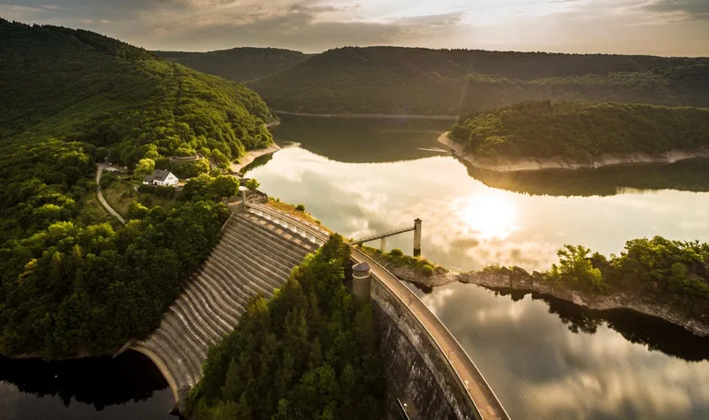
Eifelsteig Stage 4: From Einruhr through Eifel National Park to Gemünd Eifelsteig Stage 4 begins in Einruhr, from where the route first gently climbs and loops around the surrounding area. The trail then leads through the emerging “primeval forest of tomorrow” in Eifel National Park, where nature follows its own laws. The glittering waters of Upper Lake point the way, with the route running close to the rugged rocky shore. Between forest and water rises the imposing Urft Dam, a mighty, steadfast historic structure and one of the oldest dams in Germany. Crossing the dam opens up far-reaching views of the water surface and the surrounding woodland landscape. A place to stop for refreshments is available. Further along, the path climbs uphill, where a sweeping panorama opens up over the dam and the lake landscape. On the heights, you reach a broad, open landscape — the Dreiborn Plateau, which shines in early summer with bright yellow broom. This region offers extensive views of the surroundings and conveys a sense of openness and untouched nature. The low light pollution also earns the region the designation of a Dark Sky Park, revealing an impressive firmament on clear nights. The onward route across the plateau passes the deserted village of Wollseifen, with a striking tower coming into view on the horizon. This tower is part of the former Nazi Ordensburg Vogelsang. The complex now serves as an international place for tolerance and diversity. The grounds house a National Park Center as well as an exhibition on the history of Vogelsang. A stop there offers far-reaching views of Lake Urft and the Dreiborn Plateau. The route then descends into the valley of the Urft, heading toward the stage destination of Gemünd. Along the way, the viewpoints of Kickley and Modenhübel offer additional sweeping perspectives on the Eifel landscape.

21.2 km approx. 6:45 h Point-to-point Hiking
View details
Ascent
574 m
Descent
509 m
Highest point
520 m
Lowest point
278 m
Elevation profile
200 m 400 m 600 m
10 km 16 km 0 km 21 km

Elevation profile calculated by Fairvisit from satellite elevation data. Ascent and descent usually differ by up to about 10 %, more on steep terrain.
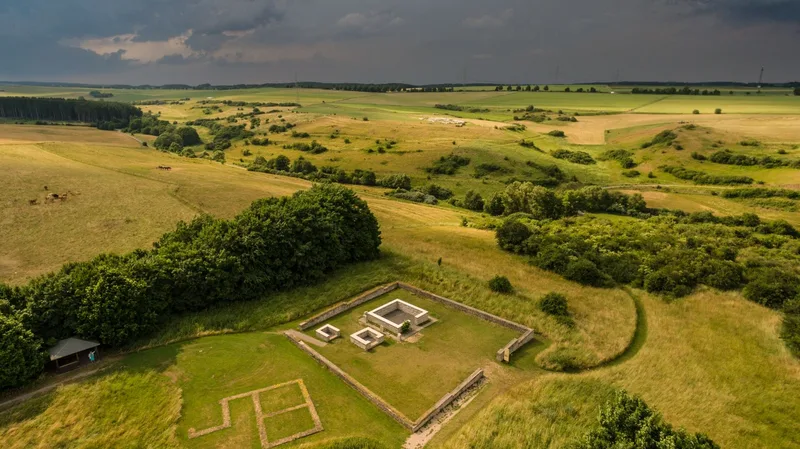
Gemünd → Kloster Steinfeld

Stage 5

The fifth stage of the Eifelsteig stretches from Gemünd to Steinfeld Monastery. The starting point of the hike is Schleiden-Gemünd, at the confluence of the Olef and the Urft. The route begins at the mouth of the Olef and initially follows a steadily ascending forest path. This section offers an immersive woodland experience, with winding trails leading to a viewpoint. From Kuckucksley, there is a view over the broad, wooded Olef Valley and the village of Olef, which is the next stage destination. The village square, characterized by historic half-timbered houses and a village church, creates a harmonious overall impression. The Olef Valley is then left behind, and the trail continues through quiet forest sections. Along the path, there are abandoned ore mines and prospecting sites, which serve as evidence of the area's former mining history. After the village of Golbach, the landscape opens up, and Steinfeld Monastery becomes visible as the stage destination. The route leads along streams and meadows, creating a contemplative atmosphere. The monastery grounds are reached, with its medieval walls standing out prominently. Access to the monastery area allows entry into an environment that invites inner reflection and contemplation. Inside the monastery is the tomb of Saint Hermann Josef, whose visit is a special highlight of the stage.

17.5 km approx. 5:30 h Point-to-point Hiking
View details
Ascent
491 m
Descent
313 m
Highest point
535 m
Lowest point
334 m
Elevation profile
200 m 400 m 600 m
5.0 km 8.5 km 0 km 17 km

Elevation profile calculated by Fairvisit from satellite elevation data. Ascent and descent usually differ by up to about 10 %, more on steep terrain.
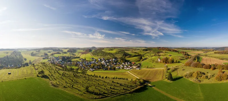
Kloster Steinfeld → Blankenheim

Stage 6

The sixth stage of the Eifelsteig stretches from Steinfeld Monastery via the nature experience village of Nettersheim to Blankenheim. This stage combines traces of Roman history and medieval culture. The starting point is the medieval Steinfeld Monastery. From its contemplative walls, the trail descends into the valley of the Gillesbach. A subsequent climb up the Königsberg offers a sweeping view of the towers of Steinfeld Monastery. The path leads through dense tree canopies until the Urft shapes the landscape of the valley meadows. A prominently framed spring marks another water treasure along the route. The significance of this natural treasure, especially at the Grüner Pütz, was already recognized by the Romans, who established their own aqueduct here to supply water to Cologne. Legends say that Medusa figures guard the spring and that a direct gaze at them carries the risk of being turned to stone. The route continues through Nettersheim, which offers places to stop for refreshments. The trail then runs along a wooden walkway beside the Römerweiher. An optional detour leads to the Roman temple complex of Görresburg. The landscape is characterized by meadows, floodplains, and stretches of woodland. The day’s destination, Blankenheim, welcomes visitors with an imposing castle, whose origins are believed to lie in a Roman fort. The later medieval complex was given Baroque elements and today houses a youth hostel. Blankenheim’s historic town center invites you to end the day with a stroll through its half-timbered lanes, where the source of the Ahr can also be discovered.

23.4 km approx. 7:15 h Point-to-point Hiking
View details
Ascent
490 m
Descent
545 m
Highest point
566 m
Lowest point
412 m
Elevation profile
200 m 400 m 600 m
6.0 km 0 km 23 km

Elevation profile calculated by Fairvisit from satellite elevation data. Ascent and descent usually differ by up to about 10 %, more on steep terrain.

Blankenheim → Mirbach

Stage 7

Eifelsteig stage 7 stretches from Blankenheim to Mirbach. The starting point of this tour holds a remarkable feature: beneath a historic building in Blankenheim’s old town, the Ahr rises, where it has its source. From the source area of the Ahr, the Eifelsteig leads into wooded regions. At first, the trail follows the historic Bread Path through varied terrain. This path once served to transport and distribute baked goods to Blankenheim, which led to the merchants moving briskly. Today, the route offers a contemplative exploration, including the ascent to a hilltop. There, hikers are greeted by the distinctive Bread Path Hut, whose appeal becomes immediately apparent. A guestbook is provided, offering the opportunity to leave a personal mark on the Eifelsteig. After a rest break, the trail continues through expansive forest and meadow landscapes that open up views into the distance. Beyond Alendorf, Calvary Hill, a summit at an elevation of 520 meters, is gradually climbed. A refreshing wind accompanies the ascent and conveys a feeling of openness and achievement. The clear mountain air invites you to pause and take a deep breath. In the summit area, slender, lush green junipers can be found, whose presence in Alendorf is honored each year with a festival and juniper schnapps. From Calvary Hill, the stage destination is already in sight. Following the gently meandering Mirbach, you reach the village. There stands an architecturally appealing chapel, which is recommended for a visit. The Redeemer Chapel fascinates with thousands of golden mosaic stones that bathe the interior in a unique light and form an impressive conclusion to the stage.

17.7 km approx. 5:30 h Point-to-point Hiking
View details
Ascent
362 m
Descent
373 m
Highest point
550 m
Lowest point
407 m
Elevation profile
200 m 400 m 600 m
6.4 km 11 km 0 km 17 km

Elevation profile calculated by Fairvisit from satellite elevation data. Ascent and descent usually differ by up to about 10 %, more on steep terrain.

Mirbach → Hillesheim

Stage 8

25.9 km approx. 7:45 h Point-to-point Hiking
View details
Ascent
444 m
Descent
466 m
Elevation profile
200 m 400 m 600 m
12 km 18 km 0 km 25 km

Elevation profile calculated by Fairvisit from satellite elevation data. Ascent and descent usually differ by up to about 10 %, more on steep terrain.

Hillesheim → Gerolstein

Stage 9

20.1 km approx. 6:30 h Point-to-point Hiking
View details
Ascent
489 m
Descent
561 m
Elevation profile
200 m 400 m 600 m
4.1 km 10 km 14 km 0 km 20 km

Elevation profile calculated by Fairvisit from satellite elevation data. Ascent and descent usually differ by up to about 10 %, more on steep terrain.

Gerolstein → Daun

Stage 10

23.8 km approx. 8:00 h Point-to-point Hiking
View details
Ascent
773 m
Descent
681 m
Elevation profile
200 m 400 m 600 m
9.3 km 15 km 0 km 23 km

Elevation profile calculated by Fairvisit from satellite elevation data. Ascent and descent usually differ by up to about 10 %, more on steep terrain.

Daun → Manderscheid

Stage 11

23.3 km approx. 7:30 h Point-to-point Hiking
View details
Ascent
565 m
Descent
661 m
Elevation profile
200 m 400 m 600 m
8.9 km 0 km 23 km

Elevation profile calculated by Fairvisit from satellite elevation data. Ascent and descent usually differ by up to about 10 %, more on steep terrain.

Manderscheid → Kloster Himmerod

Stage 12

18.2 km approx. 5:45 h Point-to-point Hiking
View details
Ascent
448 m
Descent
517 m
Elevation profile
200 m 400 m 600 m
5.4 km 11 km 0 km 18 km

Elevation profile calculated by Fairvisit from satellite elevation data. Ascent and descent usually differ by up to about 10 %, more on steep terrain.

Kloster Himmerod → Bruch

Stage 13

19.9 km approx. 6:00 h Point-to-point Hiking
View details
Ascent
351 m
Descent
461 m
Elevation profile
200 m 400 m 600 m
5.7 km 11 km 15 km 0 km 20 km

Elevation profile calculated by Fairvisit from satellite elevation data. Ascent and descent usually differ by up to about 10 %, more on steep terrain.

Source: OpenStreetMap contributors · ODbL

Bruch → Daufenbach

Stage 14

Since 2021 this stage has ended at the Deimlinger Mühle because a bridge was destroyed. From there, a footpath leads to Daufenbach station (about 1.3 km); continue to Kordel by train or bus.

23.8 km approx. 7:15 h Point-to-point Hiking
View details
Ascent
428 m
Descent
456 m
Elevation profile
200 m 400 m 600 m
11 km 17 km 0 km 24 km

Elevation profile calculated by Fairvisit from satellite elevation data. Ascent and descent usually differ by up to about 10 %, more on steep terrain.

Source: OpenStreetMap contributors · ODbL

Kordel → Trier

Stage 15

15.1 km approx. 5:15 h Point-to-point Hiking
View details
Ascent
594 m
Descent
570 m
Elevation profile
200 m 400 m 600 m
4.7 km 10 km 0 km 15 km

Elevation profile calculated by Fairvisit from satellite elevation data. Ascent and descent usually differ by up to about 10 %, more on steep terrain.

Source: OpenStreetMap contributors · ODbL

Elevation data

produced using Copernicus WorldDEM-30 © DLR e.V. 2010-2014 and © Airbus Defence and Space GmbH 2014-2018 provided under COPERNICUS by the European Union and ESA; all rights reserved

The organisations in charge of the Copernicus programme by law or by delegation do not incur any liability for any use of the Copernicus WorldDEM-30.

Regions along the route

The route passes through these regions. Each region guide shows the stages running through it, along with places to stay nearby.

Saved