Eifelsteig · Stage 6 of 15
Eifelsteig Stage 06
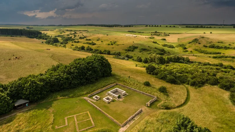
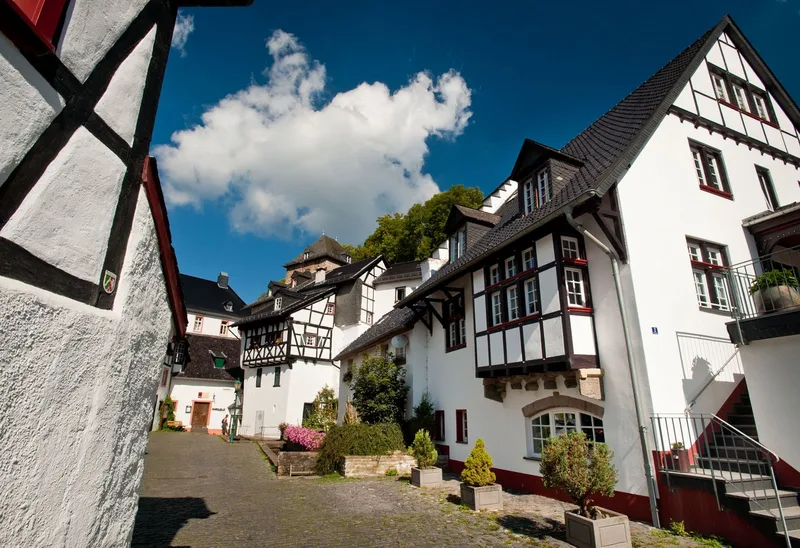
The sixth stage of the Eifelsteig stretches from Steinfeld Monastery via the nature experience village of Nettersheim to Blankenheim. This stage combines traces of Roman history and medieval culture. The starting point is the medieval Steinfeld Monastery. From its contemplative walls, the trail descends into the valley of the Gillesbach. A subsequent climb up the Königsberg offers a sweeping view of the towers of Steinfeld Monastery. The path leads through dense tree canopies until the Urft shapes the landscape of the valley meadows. A prominently framed spring marks another water treasure along the route. The significance of this natural treasure, especially at the Grüner Pütz, was already recognized by the Romans, who established their own aqueduct here to supply water to Cologne. Legends say that Medusa figures guard the spring and that a direct gaze at them carries the risk of being turned to stone. The route continues through Nettersheim, which offers places to stop for refreshments. The trail then runs along a wooden walkway beside the Römerweiher. An optional detour leads to the Roman temple complex of Görresburg. The landscape is characterized by meadows, floodplains, and stretches of woodland. The day’s destination, Blankenheim, welcomes visitors with an imposing castle, whose origins are believed to lie in a Roman fort. The later medieval complex was given Baroque elements and today houses a youth hostel. Blankenheim’s historic town center invites you to end the day with a stroll through its half-timbered lanes, where the source of the Ahr can also be discovered.
- Length
- 23.4 km
- Walking time
- approx. 7:15 h
- Ascent
- 490 m
- Descent
- 545 m
Walking time as stated by the operator.
Elevation profile calculated by Fairvisit from satellite elevation data. Ascent and descent usually differ by up to about 10 %, more on steep terrain.
Start
Hermann-Josef-Straße 4, 53925 Kloster Steinfeld,
Nearby
Along the way
Finish
Zentrum am Rathaus, 53945 Blankenheim
Nearby