Skip to content

Long-distance trail

Schluchtensteig

About 119 km hiking trail from Stühlingen to Wehr through the southern Black Forest and the Wutach Gorge, in 6 stages.

Stages
6
Total distance
about 119 km

Stages

Start Finish

Katholische Kirche in Stühlingen → Hauptstraße in Blumberg

Stage 1

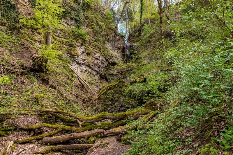
Stühlingen forms the starting point of the tour. You follow the Wutachflühen along narrow paths, past steeply rising rock towers. At Buchberg, you are rewarded with a magnificent panorama. Stühlingen, right on the Swiss border, is the starting point of our long-distance hiking trail – the gateway to an unforgettable adventure. The view of Hohenlupfen Castle, the town’s landmark, sets the mood before the landscape captivates you over the kilometers ahead. In Weizen, you pass the valley station of the famous “Sauschwänzlebahn.” The nostalgic whistle of the steam locomotive will accompany you again and again on this stage. In Lausheim-Blumegg, a detour to the historic museum mill in the hamlet is worthwhile before the adventure really begins: you head into the spectacular rock faces of the Wutachflühen nature reserve. The “Flühen” (= cliffs) reveal their wild beauty here: steeply rising rock towers, giant ferns, moss-covered stones, and gnarled roots show a “primeval forest section” of the Southern Black Forest. On partly exposed narrow paths, you experience nature in its purest form – sure-footedness is absolutely essential here! Shade-giving trees then guide you on the ascent to the Buchberg viewpoint. From the rest area there, you can enjoy the sweeping view over the conquered Wutachflühen and the promising route of the next day. If you have good stamina, you can extend stage 1 to Wutachmühle (total then approx. 26 km, 8 hours).

18.4 km approx. 6:15 h Point-to-point Hiking
View details
Ascent
688 m
Descent
435 m
Elevation profile
500 m 1,000 m
6.5 km 0 km 18 km

Elevation profile calculated by Fairvisit from satellite elevation data. Ascent and descent usually differ by up to about 10 %, more on steep terrain.
Blumberg → Schattenmühle

Stage 2

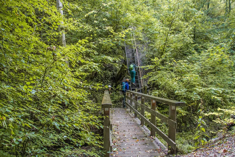
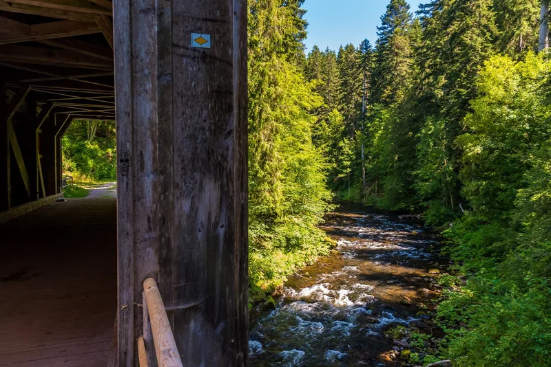
The Wutach Gorge adventure begins at the Wutachmühle sawmill. Here the valley becomes ever narrower and more primeval. Toward the end, the trail climbs to the stage destination at Schattenmühle at the exit of the Lotenbach Gorge. Immerse yourself in the breathtaking Wutach Gorge adventure. Narrow paths hug the water, repeatedly leading you across the wild Wutach on footbridges or along the cliffs above the roaring mountain stream. Well-secured rock galleries and ladders with rope handrails ensure your safe footing. This stage begins with a small test of courage: an 8-meter-long, steep stair ladder takes you down into the small gorge of the Schleifenbach, whose water plunges 20 meters in three spectacular cascades – a nature experience that gets under your skin! (Important note for all adventure lovers with four-legged companions: you can find a detour for dogs on our website.) The route continues to the mysterious Wutach spring, where seeped-in water gushes impressively and vividly out of the mountain into the open. The valley around you becomes ever wilder and narrower, the path winds over a carpet of roots directly along the Wutach, and the vegetation increasingly envelops you in an ever more primeval atmosphere. Majestic rock faces soon rise to your left, secured by a wire-rope handrail. A well-deserved break can be taken at the Schurhammerhütte rest area, where benches invite you to linger and recharge your energy. Afterwards, the path winds up into the rocks, past the rushing Tannegg Waterfall and the traces of the former spa resort Bad Boll, until you reach your stage destination at Schattenmühle. From here, you can continue comfortably—either by local bus, on foot, or by arrangement with your host—to your well-deserved accommodation in Bonndorf, Löffingen, Bräunlingen or Hüfingen.

20.2 km approx. 6:15 h Point-to-point Hiking
View details
Ascent
416 m
Descent
441 m
Elevation profile
500 m 1,000 m
6.0 km 14 km 0 km 20 km

Elevation profile calculated by Fairvisit from satellite elevation data. Ascent and descent usually differ by up to about 10 %, more on steep terrain.
Schattenmühle → Schluchsee-Fischbach

Stage 3

From Schattenmühle, the remains of Räuberschlössle are soon reached. From the mouth of the Rötenbach, the trail turns toward Haslach Gorge. Via Lenzkirch, Oberfischbach is reached through the romantically quiet Schwendetal. Narrow paths, breathtaking rock ledges, the ever-present rushing Wutach, and two worthwhile detours make this section a full-day experience. Right at the start, a detour to nearby Lotenbach Gorge is worthwhile. A few steps later, the first waterfall is already rushing through the closely spaced rocks. Directly at Schattenmühle, the Schluchtensteig climbs steeply up the forested slope, then follows the valley floor for quite a stretch at a pleasantly horizontal level and rises almost imperceptibly to the northern edge of the valley up onto the Baar. The few remains of Räuberschlössle stand on an 80-meter-high rock directly above one of the wildest and most impressive gorge sections. Below the nearby Stallegg ruins, the Wutach thunders with deafening noise over the weir of the Stallegg hydroelectric power plant, the oldest of its kind in Baden. Then the route continues upstream along the Wutach. Long scree slopes stretch from Hörnle down to the river; over hill and dale, the mouth of the Haslach and Haslach Gorge are reached. After Lenzkirch, the trail leads through the romantically quiet Schwendetal to Oberfischbach.

18.0 km approx. 6:00 h Point-to-point Hiking
View details
Ascent
684 m
Descent
315 m
Elevation profile
500 m 1,000 m
0 km 18 km

Elevation profile calculated by Fairvisit from satellite elevation data. Ascent and descent usually differ by up to about 10 %, more on steep terrain.
Oberfischbach → St. Blasien

Stage 4

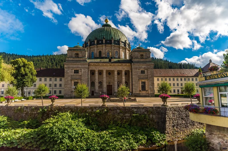
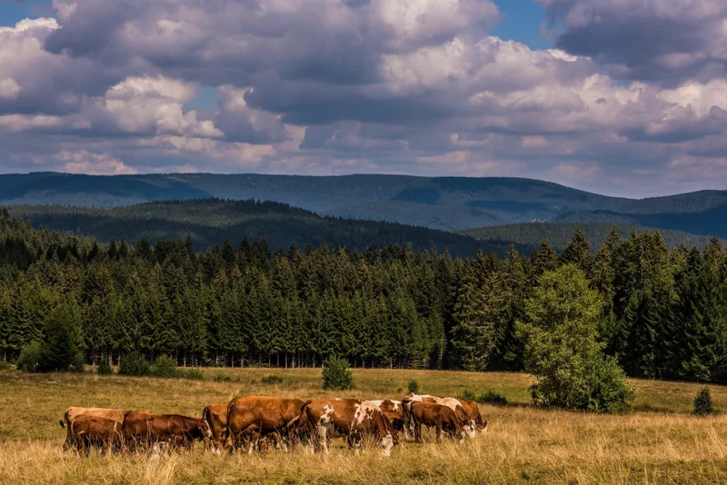
Magnificent views at Bildsteinfelsen or near Muchenland, the pleasant paths along the shore of Lake Schluchsee, and the little Windberg Gorge are the highlights of this stage. Just a few kilometers from the stage start in Oberfischbach, the rocky summit of Bildstein rises out of the fir and spruce forests. From the highest viewpoint on the entire Schluchtensteig, a magnificent panorama opens up: the view sweeps over the glittering Schluchsee to the distant Alps. Once a glacial lake, Schluchsee was dammed and is now Germany’s highest reservoir — a paradise for swimming, water sports, or a leisurely boat trip. After circling the western shore and stopping at the Unterkrummenhof snack bar, the trail leads back into quiet forests. It climbs moderately but steadily to the highest point on the trail, Krummenkreuz, where a clearing with a rest area invites you to take a break. A nostalgic photo stop awaits in Muchenland, where ancient Black Forest farmhouses tell of times gone by. Behind the mountain village of Althütte, the steep descent into the Alb Valley begins. Soon the roar of Windberg Waterfall can be heard — a sign that the grand finale of this stage is near. The path winds downhill along the Windberg Brook over bridges and rocks. On the edge of St. Blasien, the view opens onto the imposing Cathedral of St. Blasius, which stands majestically between forests and mountains. Here, in the well-kept parkland on the gently rippling banks of the Alb, an eventful day of hiking full of nature, silence, and impressive views comes to an end.

19.7 km approx. 6:15 h Point-to-point Hiking
View details
Ascent
439 m
Descent
710 m
Elevation profile
500 m 1,000 m
5.4 km 11 km 0 km 20 km

Elevation profile calculated by Fairvisit from satellite elevation data. Ascent and descent usually differ by up to about 10 %, more on steep terrain.
St. Blasien → Todtmoos

Stage 5

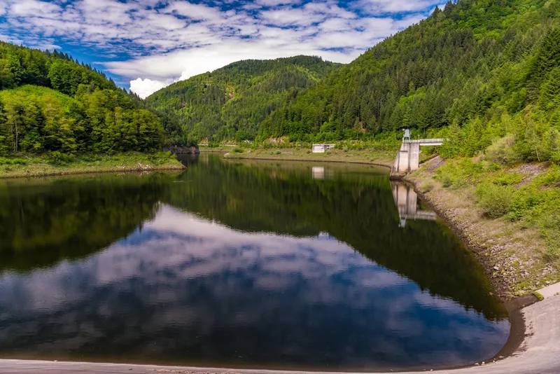
Narrow paths through the typical open landscape of the Hotzenwald, with its mountain meadows and views as far as the Alps, and the Hohwehraschlucht gorge give Stage 5 its appeal. You start your stage in the spa park of St. Blasien, and after just a few minutes you tackle the first ascent to the 1,039-meter Lehenkopf. After the Lusthausfelsen, one last impressive panorama opens up before you: the imposing cathedral, the huge monastery complex, and the charming spa town. From the wooden observation tower on the Lehenkopf, you will be richly rewarded for your efforts: breathtaking long-distance views stretch as far as the highest point of the Black Forest – the Feldberg – and in the south even to the Alps. From Dachsberg, the trail enters the characteristic open landscape of the Hotzenwald. Here, species-rich mountain meadows protected as nature reserves glow, interspersed with a colorful carpet of wildflowers, and again and again new panoramic views open up to the Swiss Alps. From the tranquil Klosterweiher, the path leads up onto the broad plateau to the Kreuzfelsen, which attracts visitors with a shelter hut and a magnificent view, before continuing on to Ibach. After the Ibacher Kreuz, the landscape changes once again. The Schluchtensteig winds steeply down in zigzag curves into the Hohwehraschlucht gorge, directly to the gates of the historic pilgrimage and spa town of Todtmoos.

18.9 km approx. 6:00 h Point-to-point Hiking
View details
Ascent
540 m
Descent
493 m
Elevation profile
500 m 1,000 m
6.5 km 15 km 0 km 19 km

Elevation profile calculated by Fairvisit from satellite elevation data. Ascent and descent usually differ by up to about 10 %, more on steep terrain.

Todtmoos - Hauptstraße → Wehr - Zielstation beim Alten und Neuen Schloss

Stage 6

The final stage from Todtmoos through the Wehr Gorge begins gently and pleasantly. In the valley floor, the valley sides draw closer together and become steeper and rockier, and the path narrower. The final stage from Todtmoos through the Wehr Gorge initially begins gently and pleasantly. Behind the babbling hamlet of Schwarzenbach, the Schluchtensteig then leads through a lively mixed forest. Once you reach the valley floor, you cross the rushing waters of the Wehra. The mighty rock walls of the Bannwald rise up to 200 meters above the river roaring far below. Here you can see how the forest develops without human intervention. Again and again, breathtaking views down into the depths or sweeping panoramas across to the other side of the valley open up. With a bit of luck, you may spot a few shy chamois as they elegantly climb the steep walls. At the idyllic rest area by the Mettler Hut, you have one more chance to fully enjoy the magnificent long-distance views as far as the Swiss Alps. Gradually, the trail then loses altitude until you cross the impressive dam wall of the Wehra Reservoir. Afterwards, a relaxed end to your tour follows along the babbling river, past the inviting swimming pool, which invites you to cool off after the demanding, long tour, until you reach your final destination in the castle park. There, the Old and New Castle of the Lords of Schönau stand proudly in the heart of the historic weaving and textile town.

22.8 km approx. 8:30 h Point-to-point Hiking
View details
Ascent
832 m
Descent
1297 m
Elevation profile
500 m 1,000 m
15 km 0 km 23 km

Elevation profile calculated by Fairvisit from satellite elevation data. Ascent and descent usually differ by up to about 10 %, more on steep terrain.

Elevation data

produced using Copernicus WorldDEM-30 © DLR e.V. 2010-2014 and © Airbus Defence and Space GmbH 2014-2018 provided under COPERNICUS by the European Union and ESA; all rights reserved

The organisations in charge of the Copernicus programme by law or by delegation do not incur any liability for any use of the Copernicus WorldDEM-30.

Saved