Skip to content

Long-distance trail

Neckartal-Radweg

About 370 km cycle route along the Neckar, from its source in Villingen-Schwenningen to its mouth on the Rhine in Mannheim, in 8 stages.

Stages
8
Total distance
about 370 km

Stages

Start Finish

Villingen Bahnhof → Rottweil Hauptstraße

Stage 1

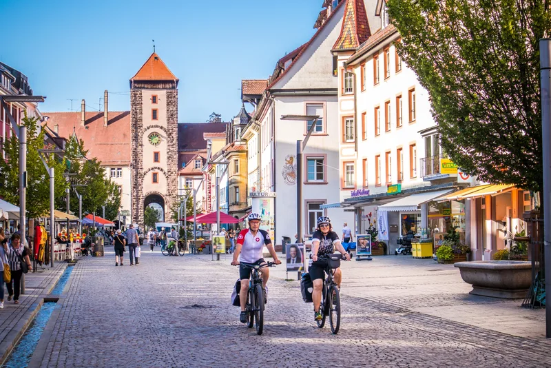
The first stage of the Neckar Valley Cycle Route is a cultural and scenic experience. It begins in the twin city of Villingen-Schwenningen, one part of which — Villingen — once lay in Baden, while Schwenningen is old Württemberg territory. An attractive combination with an old town in Villingen that recalls the great history of the Zähringen. On the way to Schwenningen, one first encounters the namesake of the cycle route: from a small opening in the moor, the source of the Neckar gushes forth, set in stone and marked by name. A lovely place to pause for a moment. From now on, the river is a constant companion, a gurgling stream that here still ripples gently through the landscape. This section near Dauchingen and Deißlingen is affectionately also called the “Neckartäle.” At the end of this short first stage lies another piece of regional history: with over 2,000 years of history, Rottweil is the oldest town in Baden-Württemberg.

27.3 km approx. 7:15 h Point-to-point Cycling
View details
Ascent
89 m
Descent
198 m
Elevation profile
250 m 500 m 750 m
0 km 27 km

Elevation profile calculated by Fairvisit from satellite elevation data. Ascent and descent usually differ by up to about 10 %, more on steep terrain.
Source: Geschäftsstelle Neckartal-Radweg · CC BY-SA 4.0 Open route description (external link)

Rottweil → Horb am Neckar

Stage 2

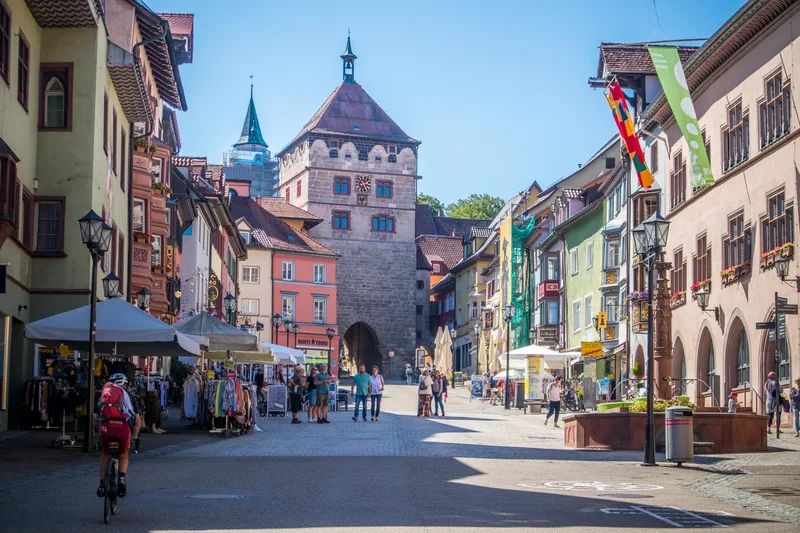
Between Rottweil and Horb, the Neckar gradually picks up speed, transforming from a small brook into a river. In the middle of a picturesque landscape, it winds around mountains, meanders through meadows and fields, and treats cyclists to downhill stretches. Not long after the old town of Rottweil, the defensive walls of the ruins of Neckarburg come into view. Steep slopes, rocks, and gorge-like side valleys follow. Here, the Black Forest and the Swabian Alb meet with a river in the middle that is heading north. In Oberndorf, the fools lie in wait for it, the wild fellows of the Swabian-Alemannic Fasnet, whose fools' fountain is a wonderful place to cool off even after Ash Wednesday. On the way to Sulz and Horb, one or two detours are worthwhile, for example to the Jewish synagogue in Rexingen or the moated castle in Glatt. At the destination in Horb, the Neckar is already a truly impressive body of water, above which the old town rises majestically, serving in summer as the backdrop for the widely known knight games.

47.9 km approx. 13:00 h Point-to-point Cycling
View details
Ascent
302 m
Descent
514 m
Elevation profile
250 m 500 m 750 m
26 km 0 km 48 km

Elevation profile calculated by Fairvisit from satellite elevation data. Ascent and descent usually differ by up to about 10 %, more on steep terrain.
Source: Geschäftsstelle Neckartal-Radweg · CC BY-SA 4.0 Open route description (external link)

Horb am Neckar → Tübingen

Stage 3

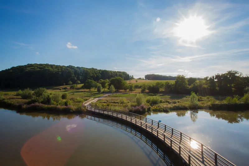
Historic Swabia! From Horb to Tübingen, you pass through several half-timbered towns with a great past and modern flair. Horb bids farewell to cyclists with one of the most beautiful half-timbered backdrops in the country and sends them off into an idyllic river landscape with many small villages. The Neckar bends to the northeast and cuts ever deeper into the heartland of Württemberg. Romans settled in Rottenburg long ago, and much later so did the Catholic bishop of a new diocese, which still has its seat there today. Around the Cathedral and the historic market fountain, shops and cafés invite visitors to linger. Just a little over ten kilometers away lies the old Protestant heart of Württemberg: the university town of Tübingen. Between the two very different places, the Wurmlingen Chapel looks down from a hill - a picturesque landmark visible for miles. It is as defining for the stage as the Hölderlin Tower on the banks of the Neckar in Tübingen, which you reach at the end of this stage.

35.5 km approx. 9:30 h Point-to-point Cycling
View details
Ascent
200 m
Descent
266 m
Elevation profile
250 m 500 m 750 m
12 km 19 km 0 km 35 km

Elevation profile calculated by Fairvisit from satellite elevation data. Ascent and descent usually differ by up to about 10 %, more on steep terrain.
Tübingen → Esslingen am Neckar

Stage 4

On this stage, the Neckar finally becomes a proper river, so large that from Plochingen onward it is actually navigable. A federal waterway! At the starting point in Tübingen, there were still somewhat smaller boats lying along the bank. Punt boat rides are among the favorite leisure activities of Tübingen’s residents, and the students here have truly mastered the art. On the way to Nürtingen, numerous reservoirs and ponds accompany the Neckar, resting places for people, but also for birds that find their refuges here. The journey continues at a leisurely pace through the old half-timbered town of Nürtingen, whose landmark, St. Laurentius Church, rises above the old town with its tower. Again and again, the silhouette of the Swabian Alb appears on the right-hand side of the route; at its foot, a few kilometers from the cycling route, lies the old imperial city of Reutlingen. At the stage destination in Esslingen, the next half-timbered backdrop awaits visitors, in a superbly preserved old town that attracts thousands of visitors every year.

52.0 km approx. 13:15 h Point-to-point Cycling
View details
Ascent
36 m
Descent
130 m
Elevation profile
250 m 500 m 750 m
0 km 52 km

Elevation profile calculated by Fairvisit from satellite elevation data. Ascent and descent usually differ by up to about 10 %, more on steep terrain.

Source: Geschäftsstelle Neckartal-Radweg · CC BY-SA 4.0 Open route description (external link)

Esslingen am Neckar → Besigheim

Stage 5

The stage leads through the heart of Württemberg. The state capital Stuttgart lies along the route, as does the splendid residence in Ludwigsburg, which the dukes had built just outside the city gates. Baroque flourishes here in a large palace garden, but wine also thrives wonderfully on the banks of the Neckar, where barges and excursion boats now ply the river. Even in Esslingen, steep vineyards rise above the town, at the top of which stands a castle that is in fact only the remains of the city wall. Just before the gates of Stuttgart, the Württembergs' burial chapel crowns the vineyards; down in the valley, the Wine Museum in Uhlbach tells the story of the fine drops. There is truth in wine, but also plenty of poetry, which unfolds especially picturesquely in the birthplace of Friedrich Schiller in Marbach am Neckar. The detour to the Schiller National Museum is almost obligatory before continuing on, buoyed by the ride and winding turn after winding turn, toward Besigheim.

59.1 km approx. 15:00 h Point-to-point Cycling
View details
Ascent
49 m
Descent
100 m
Elevation profile
250 m 500 m 750 m
16 km 30 km 47 km 0 km 59 km

Elevation profile calculated by Fairvisit from satellite elevation data. Ascent and descent usually differ by up to about 10 %, more on steep terrain.
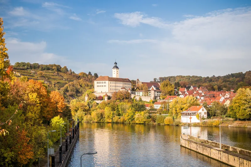
Besigheim → Bad Wimpfen

Stage 6

Wine enjoyment for all the senses The 6th stage of the Neckar Valley Cycle Route is lined by imposing steep slopes and gentle vineyard hills. Especially in autumn, it creates an impressive play of colors. While the eye is delighted during the day, it is the taste buds that are treated after the tour. In the regionally typical Besenwirtschaften and wineries, the day ends with a good glass of wine. The winding lanes of Besigheim are an experience. High above the Neckar, the old town towers over the river, a delight for every visitor. Lauffen is similarly tranquil to Besigheim, where the famous Katzenbeißer is grown. Viticulture still dominates the banks of the Neckar, and small Wengerter houses peek out from the slopes beside the river. The capital of Württemberg winegrowing is Heilbronn. Like in an amphitheater, the city is surrounded by vineyards. Here stands experimenta, Germany's largest science center. And much else has changed as well with the 2019 Federal Garden Show. Like a green lung, the Neckar runs almost like a park through the city center. City Beach or Neckar Stage invite you to dangle your legs in the water while taking a break. Further on toward the mouth of the river, a salt mine can be visited in Bad Friedrichshall. Then, on the opposite bank of the river, another city rich in history awaits visitors: Bad Wimpfen, the largest imperial palace of the Hohenstaufen north of the Alps and protected as a complete historic ensemble. It is recognizable from afar by its silhouette with the towers and walls on the banks of the Neckar.

38.5 km approx. 9:45 h Point-to-point Cycling
View details
Ascent
32 m
Descent
58 m
Elevation profile
250 m 500 m 750 m
15 km 0 km 38 km

Elevation profile calculated by Fairvisit from satellite elevation data. Ascent and descent usually differ by up to about 10 %, more on steep terrain.

Bad Wimpfen → Eberbach

Stage 7

No other landscape anywhere in Germany can boast such a density of castles, castle ruins, and palaces as the Neckar Valley. On the 7th stage of the cycle route, these castles await you in all their splendor. Bad Wimpfen marks the transition from Württemberg to the Electoral Palatinate, from Swabian to Baden territory, from the vineyard slopes to the red sandstone cliffs of the Odenwald. This is where the Neckar Valley castle district begins; hardly half an hour passes before the next hilltop fortress is reached. At Guttenberg Castle, real nobles still reside in walls that have remained undestroyed throughout all the centuries. Its attraction is the bird of prey center, where in season eagles and vultures majestically spread their wings over the Neckar Valley every day. A few kilometers farther on, at Hornberg Castle, the famous Götz von Berlichingen once resided before entering the history books with a curse on his lips. Castle after castle, the Neckar pushes farther into the Odenwald, accompanied by ships that must be raised to the next level at numerous locks. An experience! The stage ends in the beautiful half-timbered town of Eberbach, where the Neckar now turns 90 degrees and continues westward.

43.3 km approx. 11:30 h Point-to-point Cycling
View details
Ascent
230 m
Descent
247 m
Elevation profile
250 m 500 m 750 m
15 km 27 km 0 km 43 km

Elevation profile calculated by Fairvisit from satellite elevation data. Ascent and descent usually differ by up to about 10 %, more on steep terrain.

Source: Geschäftsstelle Neckartal-Radweg · CC BY-SA 4.0 Open route description (external link)

Eberbach → Mannheim

Stage 8

Finale! The final stage of the Neckar Valley Cycle Route is once again a highlight, with a smooth transition from the mountains into the Rhine plain. Romantic little towns and impressive castles line the course of the Neckar River. Not only because of its knightly romance have Hirschhorn and Neckarsteinach, together with Eberbach and Neckargemünd, given themselves the name “The Romantic Four”. Behind every bend, a new castle awaits visitors; this section is one of the favorite destinations of the white fleet on the Neckar, which has its home port in Heidelberg. Old Heidelberg, you lovely thing! This university town has lost none of its charm. Below lies the old town and above it the enchanting ruins of the castle, which has inspired poets for centuries. The final cycling kilometers are flat. The Upper Rhine Plain replaces the Odenwald and, in Mannheim, the Rhine finally also replaces the Neckar. You have accompanied it for 375 kilometers, from its source to its mouth in Mannheim, through a diversity of nature and culture that leaves no room for boredom.

62.2 km approx. 16:15 h Point-to-point Cycling
View details
Ascent
203 m
Descent
243 m
Elevation profile
250 m 500 m 750 m
14 km 26 km 0 km 62 km

Elevation profile calculated by Fairvisit from satellite elevation data. Ascent and descent usually differ by up to about 10 %, more on steep terrain.

Source: Geschäftsstelle Neckartal-Radweg · CC BY-SA 4.0 Open route description (external link)

Elevation data

produced using Copernicus WorldDEM-30 © DLR e.V. 2010-2014 and © Airbus Defence and Space GmbH 2014-2018 provided under COPERNICUS by the European Union and ESA; all rights reserved

The organisations in charge of the Copernicus programme by law or by delegation do not incur any liability for any use of the Copernicus WorldDEM-30.

Saved