Neckar Valley Cycle Route Stage 6: Besigheim - Bad Wimpfen
Besigheim → Bad Wimpfen
Wine enjoyment for all the senses
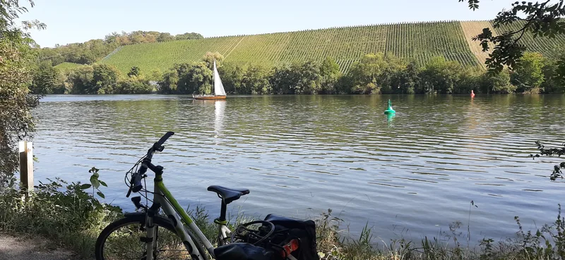
The 6th stage of the Neckar Valley Cycle Route is lined by imposing steep slopes and gentle vineyard hills. Especially in autumn, it creates an impressive play of colors.
While the eye is delighted during the day, it is the taste buds that are treated after the tour. In the regionally typical Besenwirtschaften and wineries, the day ends with a good glass of wine.
The winding lanes of Besigheim are an experience. High above the Neckar, the old town towers over the river, a delight for every visitor. Lauffen is similarly tranquil to Besigheim, where the famous Katzenbeißer is grown.
Viticulture still dominates the banks of the Neckar, and small Wengerter houses peek out from the slopes beside the river.
The capital of Württemberg winegrowing is Heilbronn. Like in an amphitheater, the city is surrounded by vineyards. Here stands experimenta, Germany's largest science center. And much else has changed as well with the 2019 Federal Garden Show. Like a green lung, the Neckar runs almost like a park through the city center. City Beach or Neckar Stage invite you to dangle your legs in the water while taking a break.
Further on toward the mouth of the river, a salt mine can be visited in Bad Friedrichshall. Then, on the opposite bank of the river, another city rich in history awaits visitors: Bad Wimpfen, the largest imperial palace of the Hohenstaufen north of the Alps and protected as a complete historic ensemble. It is recognizable from afar by its silhouette with the towers and walls on the banks of the Neckar.
Length
38.5 km
Walking time
approx. 9:45 h
Ascent
32 m
Descent
58 m
Walking time without breaks, calculated from length and elevation using the hiking standard DIN 33466 (per hour: 4 km, 300 m uphill, 500 m downhill).
Elevation profile
160 m180 m
15 km0 km38 km
Elevation profile calculated by Fairvisit from satellite elevation data. Ascent and descent usually differ by up to about 10 %, more on steep terrain.
Start
Coordinates49.00118, 9.14799
Besigheim
Along the way
Finish
Coordinates49.23028, 9.16984
Bad Wimpfen
Image rights: Geschäftsstelle Neckartal-Radweg_Maximilian Semsch · CC BY-SA 4.0
Image rights: Ulrich Seidel · CC BY 4.0
Image rights: Geschäftsstelle Neckartal-Radweg Adrian Weng · CC0 1.0
Image rights: Heilbronner Land · CC BY 4.0
Image rights: CC BY 4.0
Image rights: CC BY 4.0
Saved
Fairvisit teamOffline
Hi there!
A question or some feedback? Drop us a line – we'd love to hear from you.
We're offline right now.
Leave us a message and we'll get back to you by email:
Thanks! We've got your message and will reply by email.