Skip to content

Long-distance trail

Weserradweg

About 520 km cycle route along the Weser from Hann. Münden through the Weser Uplands to Cuxhaven on the North Sea, in 8 stages.

Stages
8
Total distance
about 520 km

Stages

Start Finish

Hann. Münden → Höxter

Stage 1

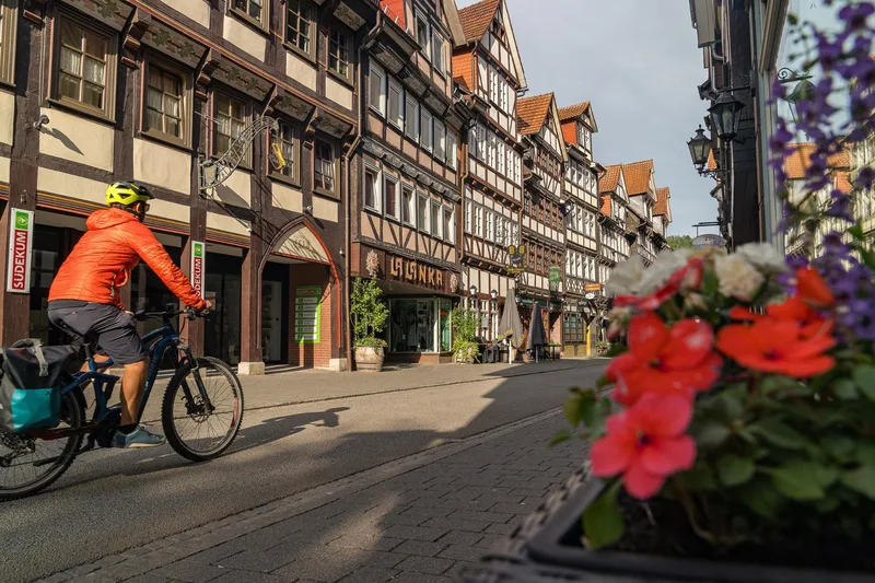
From Hann. Münden, you cycle northwards to Hemeln and continue directly along the river via Bursfelde to Oberweser. The main route of the Weser Cycle Path runs along the right bank—mostly directly along the Weser and amidst pristine nature with great views. You pass through the picturesque Lippoldsberg and Bodenfelde. Further north in Wahmbeck, the reaction ferry—operating only with the power of the water—carries you across the river. Afterwards, you reach the Baroque town of Bad Karlshafen, which invites you to pause with historical sights and the "Weser-Therme." Beverungen presents itself as a place with a lively past in a very colorful half-timbered style. In Wehrden, it is worth crossing from the main route of the Weser Cycle Path to the alternative route on the right Weser side by ferry to visit Fürstenberg Castle, which towers fairy-tale-like above the Weser Valley. The stage's destination is the half-timbered town of Höxter with numerous sights.

70.7 km approx. 18:15 h Point-to-point Cycling
View details
Ascent
187 m
Descent
244 m
Highest point
157 m
Lowest point
87 m
Elevation profile
0 m 100 m
17 km 46 km 0 km 70 km

Elevation profile calculated by Fairvisit from satellite elevation data. Ascent and descent usually differ by up to about 10 %, more on steep terrain.
Source: Weser-Radweg Infozentrale · CC BY 4.0

Höxter → Hameln

Stage 2

The town of Höxter combines picturesque half-timbered houses and medieval alleys with a lively city center. A little further north, directly on the route, is the UNESCO World Heritage Site Corvey. Continuing along the Weser brings you to Holzminden, also known as the "City of Scents and Flavors," and to Weser Renaissance castle Bevern. From there, it continues to Polle, where you can change Weser sides with the reaction ferry. Cinderella lives at Everstein Castle. Through the Rühler Schweiz, you reach Bodenwerder, the home of Baron von Münchhausen. Via Daspe, the Weser cycling route leads to the small village of Grohnde. Here it is worth switching Weser sides again with the reaction ferry to take a detour to the magnificent Hämelschenburg. To Emmerthal, it is only a short distance, from where the path leads via Tündern to Hamelin. The historic old town scores with restored half-timbered and Weser Renaissance houses.

68.3 km approx. 17:15 h Point-to-point Cycling
View details
Ascent
67 m
Descent
96 m
Highest point
95 m
Lowest point
61 m
Elevation profile
0 m 100 m
21 km 46 km 0 km 68 km

Elevation profile calculated by Fairvisit from satellite elevation data. Ascent and descent usually differ by up to about 10 %, more on steep terrain.
Source: Weser-Radweg Infozentrale · CC BY 4.0

Hameln → Minden

Stage 3

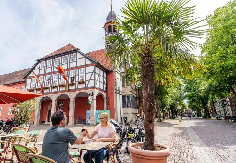
The old town of Hameln with its Weser Renaissance and half-timbered houses in the small, mysterious alleys will impress you. From Fischbecker Straße, the route continues north along the main route to the Fischbeck Foundation in Hessisch Oldendorf. Enchantingly beautiful, one of the oldest women's convents in the region is presented here. The route then continues via Großenwieden to the colorful half-timbered town of Rinteln. Narrow alleys, picturesque corners and entire rows of colorful half-timbered houses can be admired in the former university and fortress town of Rinteln. From Rinteln's city center, the main route of the Weser Cycle Path leads you to the water paradise Doktorsee. From Doktorsee, the main and alternative routes continue north via Vlotho and Bad Oeynhausen to Porta Westfalica. Here, the monumental Kaiser Wilhelm monument towers over the Weser and marks the transition from the Weser Uplands to the North German Plain. The stage destination is reached in Minden.

69.0 km approx. 17:30 h Point-to-point Cycling
View details
Ascent
67 m
Descent
89 m
Highest point
74 m
Lowest point
39 m
Elevation profile
0 m 100 m
43 km 0 km 68 km

Elevation profile calculated by Fairvisit from satellite elevation data. Ascent and descent usually differ by up to about 10 %, more on steep terrain.

Source: Weser-Radweg Infozentrale · CC BY 4.0

Minden → Nienburg

Stage 4

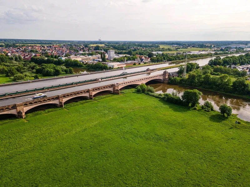
From Minden, the Weser cycle path leads through wide, gently rolling land to Petershagen. In the town center is Petershagen Castle. From Petershagen, the Weser cycle path goes north via Gernheim and Großenheerse to Buchholz with its old fortified church. Then you cycle through Schlüsselburg and Stolzenau, located directly on the Weser bank. The landmark of Stolzenau is the twisted tower spire of the St. Jacobi church. It then goes past the site of the former Benedictine monastery Schinna, one of the oldest Protestant half-timbered churches in Germany. In Landesbergen, the main route takes you across the Weser bridge into the town center of Landesbergen with the bridal mill. Along the lock canal, it continues past the Landesbergen weir to Estorf. Through Leeseringen and the Nienburg meadows, the path leads directly into the asparagus town of Nienburg. From afar, the tower of St. Martin can be seen.

58.0 km approx. 14:30 h Point-to-point Cycling
View details
Ascent
39 m
Descent
59 m
Highest point
51 m
Lowest point
21 m
Elevation profile
0 m 100 m
14 km 44 km 0 km 57 km

Elevation profile calculated by Fairvisit from satellite elevation data. Ascent and descent usually differ by up to about 10 %, more on steep terrain.
Source: Weser-Radweg Infozentrale · CC BY 4.0

Nienburg → Verden

Stage 5

From Nienburg, the Weser cycle path leads you from the harbor over the Weser bridge to Drakenburg. Passing the ship landing, the journey continues via Marklohe to Drakenburg. In Drakenburg, the old village is notable for the Weser Renaissance gateway and the St. John the Baptist Church. The ride continues close to the Weser towards Eystrup and Hoya. Over the Weser ferry Schweringen-Gandesbergen, the route switches back to the left Weser side and leads over Bücken, Hoya, and Dörverden. In Dörverden, the church and the Holländer windmill gallery attract visitors. Along the left side of the Weser, you cycle on over Magelsen and Oiste to your stage destination, the equestrian town Verden. **Please note**: Due to a construction site, the Weser cycle path is detoured behind Wienbergen to Magelsen and before Dahlhausen. The detour is signposted and stored in the system here.

58.7 km approx. 14:45 h Point-to-point Cycling
View details
Ascent
31 m
Descent
39 m
Highest point
27 m
Lowest point
9 m
Elevation profile
0 m 100 m
16 km 29 km 41 km 0 km 58 km

Elevation profile calculated by Fairvisit from satellite elevation data. Ascent and descent usually differ by up to about 10 %, more on steep terrain.
Source: Weser-Radweg Infozentrale · CC BY 4.0

Verden → Bremen

Stage 6

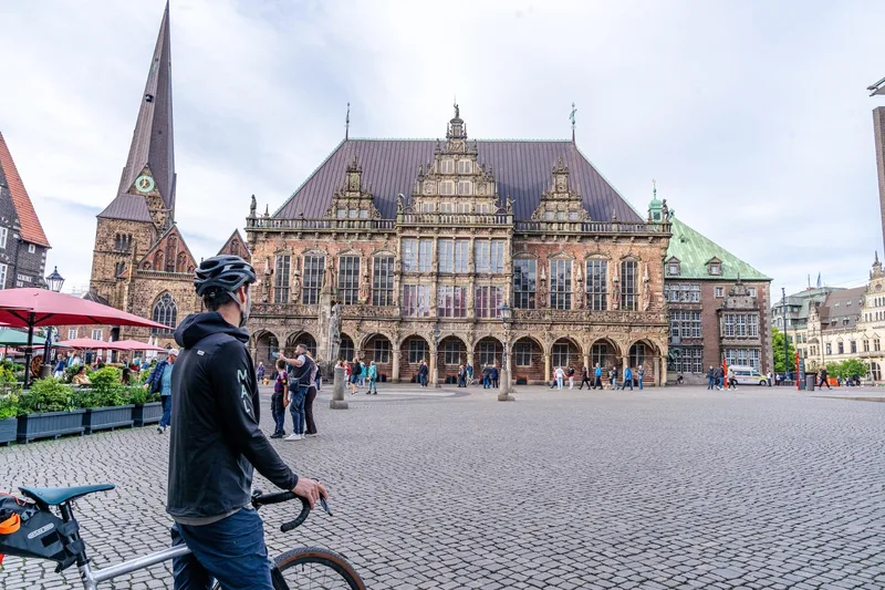
From Verden, the cycle path runs past the Langwedel lock canal by the Romanesque St. Sigismund Church in Daverden towards Achim. Just before Achim lies Etelsen, known for its castle. A few kilometers further you reach the Badener Berge in Achim-Baden, from which there is a magnificent view. Your route now leads over the Weser bridge to Thedinghausen. Erbhof Castle in Thedinghausen is an outstanding example of Weser Renaissance in the Middle Weser region. Since 1999, the Samtgemeinde Thedinghausen has been the owner of this architectural and cultural-historical jewel. From Thedinghausen, the Weser cycle path leads to Dreye in the municipality of Weyhe. In the station area, a museum steam locomotive from 1942 commemorates the railway history of Weyhe. The "Wieltsee" yacht harbor is the largest marina in the Middle Weser region. Passing the Werdersee, the path leads directly into the city center of the Hanseatic city of Bremen.

56.6 km approx. 14:15 h Point-to-point Cycling
View details
Ascent
52 m
Descent
58 m
Highest point
24 m
Elevation profile
0 m 100 m
17 km 28 km 0 km 56 km

Elevation profile calculated by Fairvisit from satellite elevation data. Ascent and descent usually differ by up to about 10 %, more on steep terrain.

Source: Weser-Radweg Infozentrale · CC BY 4.0

Bremen → Nordenham/Bremerhaven

Stage 7

From Bremen's Weser promenade, cycle past the Beck & Co brewery, along the Neustädter harbor, and over the Ochtum flood barrier into the Wesermarsch, one of the largest contiguous grassland regions in Europe. Between Lemwerder and Berne, the influence of traditional shipyards prevails. Cyclists on the Weser cycle path reach the seafaring town of Elsfleth via the Hunte bridge. Further north in the port city of Brake, you immerse yourself in the significant maritime past. From Brake, follow the heavily raised dyke to Rodenkirchen, where a look into St. Matthew's Church is worthwhile. Upon arrival at the train station in Nordenham, a detour to the pedestrian zone is recommended before you take the ferry from the district of Blexen to the other Weser side.

78.1 km approx. 19:45 h Point-to-point Cycling
View details
Ascent
63 m
Descent
63 m
Highest point
11 m
Lowest point
-1 m
Elevation profile
0 m 100 m
18 km 34 km 49 km 0 km 78 km

Elevation profile calculated by Fairvisit from satellite elevation data. Ascent and descent usually differ by up to about 10 %, more on steep terrain.
Source: Weser-Radweg Infozentrale · CC BY 4.0

Nordenham/Bremerhaven → Cuxhaven

Stage 8

The final stage of the Weser Cycle Route leads you along the North German dike landscapes and always parallel to the Weser River. From Wremen onwards begins the official estuary area of the Weser into the North Sea. Along the route are the idyllic cutter harbors of the Wurster North Sea Coast, the Wernerwald nature reserve, and finally the North Sea spa town of Cuxhaven. The official end of the route is reached at the northernmost point of Lower Saxony, at the height of the Kugelbake in Cuxhaven. From the dike, you can let your gaze wander over the UNESCO World Natural Heritage Wadden Sea and the world shipping route Elbe.

56.2 km approx. 14:15 h Point-to-point Cycling
View details
Ascent
35 m
Descent
41 m
Highest point
12 m
Lowest point
-1 m
Elevation profile
0 m 100 m
14 km 26 km 44 km 0 km 56 km

Elevation profile calculated by Fairvisit from satellite elevation data. Ascent and descent usually differ by up to about 10 %, more on steep terrain.

Source: Weser-Radweg Infozentrale · CC BY 4.0

From Bremen (loop)

This very special and popular long-distance cycle route runs for almost 500 kilometers along the Weser. From Hannoversch Münden to the mouth of the North Sea, the long-distance cycle route leads along a diverse and fascinating river landscape. Experience castles, palaces, dreamy half-timbered towns and harbors as well as fairytale and legendary figures. In the Wesermarsch region, cyclists can ride the Weser Cycle Path between Lemwerder and Eckwarderhörne. Enjoy the tour along black and white cows, bleating lambs and beautiful nature! SUMMARY Length: approx. 500 kilometers Route: Hannoversch Münden - Bad Karlshafen - Beverungen - Höxter - Holzminden - Bodenwerder - Hameln - Rinteln - Porta Westfalica - Minden - Petershagen - Stolzenau - Nienburg (Weser) - Verden (Aller) - Bremen - Elsfleth - Brake - Stadland - Nordenham - Bremerhaven - Cuxhaven Route through the Wesermarsch: Lemwerder - Elsfleth - Brake - Stadland - Nordenham - Eckwarderhörne **Course and places of interest Stage 7 (approx. 80 km):** From Bremen, the route leads into the Wesermarsch. The landscape is characterized by cows, sheep, pastureland and half-timbered houses. Many shipyards, ships and old cutters await you on the stretch from Lemwerder to Elsfleth. Where once traditional ships were built, today huge luxury yachts are built for the whole world. In Elsfleth, the route crosses the Hunte Bridge or the Elsflether Sand. At the quay in Elsfleth, the route leads past the sailing training ship "Lissi". Further north in the town of Brake (Unterweser), you can take a crossing on the "Guntsiet" to Harriersand or visit the Unterweser Maritime Museum. From Rodenkirchen to Nordenham, the route leads along the dyke against a beautiful backdrop. A detour to Nordenham town center is recommended here. From the district of Blexen, you can take the ferry to the other side of the Weser by bike or choose the alternative route via the Butjadingen peninsula to Eckwarderhörne.

72.6 km approx. 18:15 h Loop Cycling
View details
Ascent
16 m
Descent
17 m
Highest point
10 m
Elevation profile
0 m 100 m
20 km 34 km 51 km 0 km 72 km

Elevation profile calculated by Fairvisit from satellite elevation data. Ascent and descent usually differ by up to about 10 %, more on steep terrain.

Source: Touristikgemeinschaft Wesermarsch c/o Wirtschaftsförderung Wesermarsch GmbH · CC BY 4.0 Open route description (external link)

Elevation data

produced using Copernicus WorldDEM-30 © DLR e.V. 2010-2014 and © Airbus Defence and Space GmbH 2014-2018 provided under COPERNICUS by the European Union and ESA; all rights reserved

The organisations in charge of the Copernicus programme by law or by delegation do not incur any liability for any use of the Copernicus WorldDEM-30.

Regions along the route

The route passes through these regions. Each region guide shows the stages running through it, along with places to stay nearby.

Saved