Westweg · Stage 1
Westweg Stage 01: Pforzheim - Dobel
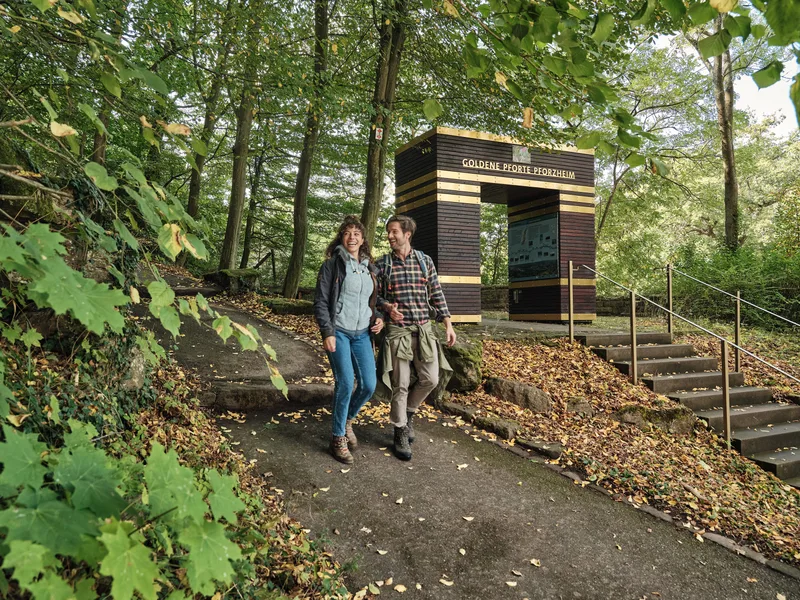
At the confluence of the three Black Forest rivers Enz, Nagold, and Würm lies the “Gold City” of Pforzheim. The former residence of the Margraves of Baden and birthplace of the humanist Johannes Reuchlin (1455-1552) is today the center of Germany’s jewelry and watch industry. At Kupferhammer begin the three best-known ridge trails of the Black Forest, the Westweg, the Mittelweg, and the Ostweg. At Kupferhammer, the confluence of the Nagold and Würm, the three major trails of the Black Forest Club begin. Anyone who does not want to take the bus there walks from Pforzheim Central Station through the city center, crosses the Enz, and follows the Nagold upstream through the city park to the hiking board and the “Golden Gate” at the start of the three long-distance trails. The Westweg and Mittelweg remain faithful to the Nagold, while the Ostweg already leaves for the Würm Valley at the starting point. At the height near the ruins of Hoheneck, the red diamonds branch off to the right over Hämmerlesberg downhill to Dillweißenstein. After the Nagold Bridge, the trail leads over Sonnenberg down into the Enz Valley and, from the Lower Enz Footbridge, follows the rushing river upstream. At the Grösselbach ford, mighty stepping stones help cross the stream. On an imposing meander hill of the Enz stands New Castle, high above the old mining town of Neuenbürg. Scenes from the famous Black Forest fairy tale “The Cold Heart” by Wilhelm Hauff can be seen in the branch museum of the Baden State Museum housed there. Down in Neuenbürg’s old town, the route goes over the bridge and the steep riverbank of the Enz up to the Wilhelmshöhe district. After a short stretch through the woods, a scenic path follows the edge of the forest above Straubenhardt. From the wooden tower of Schwanner Warte, the view sweeps as far as the Rhine Plain and the Palatinate Forest. Then the Westweg finally disappears into the dark fir forests of the Northern Black Forest. Beyond the imposing rock formation of the Great Volzemer Stone, it reaches the spa town of Dobel.
- Length
- 25.4 km
- Walking time
- approx. 7:45 h
- Ascent
- 733 m
- Descent
- 294 m
Walking time as stated by the operator.
Elevation profile calculated by Fairvisit from satellite elevation data. Ascent and descent usually differ by up to about 10 %, more on steep terrain.
Start
Pforzheim Kupferhammer
Nearby
Along the way
Finish
Dobel
Nearby