Neckarsteig · Stage 5 of 9
Neckarsteig - Stage 5: Eberbach to Neunkirchen
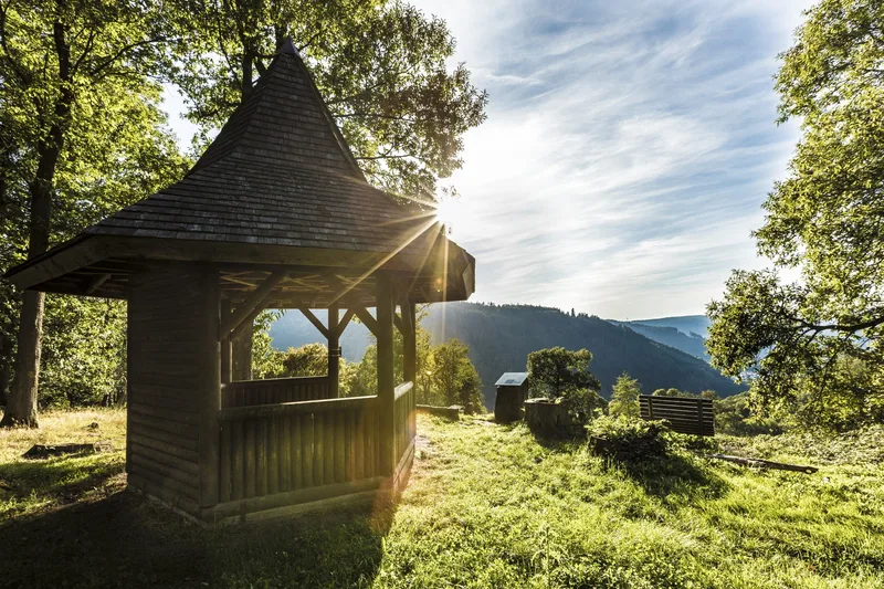
The Eberbach–Neunkirchen stage, at 18 km, is the most challenging section of the Neckarsteig. Breitenstein is Eberbach’s local mountain. The “Neckarsteig” and the “Eberbacher Path of River History” merge here into a hiking trail equipped with informative educational panels. Here you can experience in an impressive way how the Neckar carved its way through the landscape over millions of years. The orchard meadows on Breitenstein also offer plenty of flora and fauna. The Ernst-Hohn Pavilion, a shelter at Schollerbuckel, is a unique viewpoint. The Neckarsteig leads to the so-called Devil’s Pulpit along narrow paths through beautiful mixed woodland. From there you can see the Rockenau quarry as well as the lock. At Rockenau Lock, the Neckarsteig crosses to the other side of the river. Stolzeneck Castle ruin was built around 1200 and, from 1284 onward, was granted as a Palatinate fief to servants of the counts palatine. After 1610, the castle and the associated castle hamlet of Krösselbach were abandoned. You pass through almost alpine terrain in the Wilder Waibelsberg area, or the Krösselbacher slope. Sure-footedness is required here. Reihersee was originally built as a feeding pond for herons. Today it is a beautiful resting place with a shelter. The tranquil village of Neunkirchen offers hikers a complete range of food supplies with its cooperative-run citizens’ market. Neunkirchen is connected to public transport by RUFtaxi. More information at: www.neckar-odenwald-kreis.de/ruftaxi+fahrplan
- Length
- 18.4 km
- Walking time
- approx. 6:15 h
- Ascent
- 730 m
- Descent
- 522 m
Walking time as stated by the operator.
Elevation profile calculated by Fairvisit from satellite elevation data. Ascent and descent usually differ by up to about 10 %, more on steep terrain.
Start
Tourist-Information Eberbach
Nearby
Along the way
Finish
Neunkirchen Ortsrand
Nearby