Eifelsteig · Stage 4 of 15
Eifelsteig stage 04
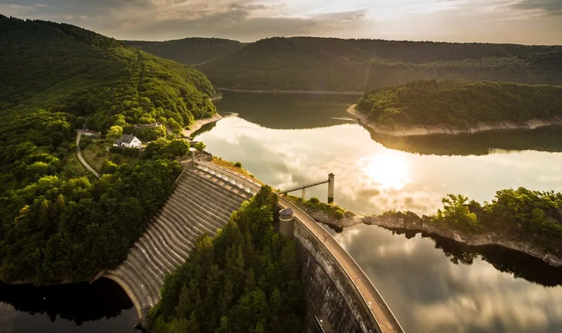
Eifelsteig Stage 4: From Einruhr through Eifel National Park to Gemünd Eifelsteig Stage 4 begins in Einruhr, from where the route first gently climbs and loops around the surrounding area. The trail then leads through the emerging “primeval forest of tomorrow” in Eifel National Park, where nature follows its own laws. The glittering waters of Upper Lake point the way, with the route running close to the rugged rocky shore. Between forest and water rises the imposing Urft Dam, a mighty, steadfast historic structure and one of the oldest dams in Germany. Crossing the dam opens up far-reaching views of the water surface and the surrounding woodland landscape. A place to stop for refreshments is available. Further along, the path climbs uphill, where a sweeping panorama opens up over the dam and the lake landscape. On the heights, you reach a broad, open landscape — the Dreiborn Plateau, which shines in early summer with bright yellow broom. This region offers extensive views of the surroundings and conveys a sense of openness and untouched nature. The low light pollution also earns the region the designation of a Dark Sky Park, revealing an impressive firmament on clear nights. The onward route across the plateau passes the deserted village of Wollseifen, with a striking tower coming into view on the horizon. This tower is part of the former Nazi Ordensburg Vogelsang. The complex now serves as an international place for tolerance and diversity. The grounds house a National Park Center as well as an exhibition on the history of Vogelsang. A stop there offers far-reaching views of Lake Urft and the Dreiborn Plateau. The route then descends into the valley of the Urft, heading toward the stage destination of Gemünd. Along the way, the viewpoints of Kickley and Modenhübel offer additional sweeping perspectives on the Eifel landscape.
- Length
- 21.2 km
- Walking time
- approx. 6:45 h
- Ascent
- 574 m
- Descent
- 509 m
Walking time as stated by the operator.
Elevation profile calculated by Fairvisit from satellite elevation data. Ascent and descent usually differ by up to about 10 %, more on steep terrain.
Start
Rurstraße; Heilenstraße, 52152 Einruhr
Nearby
Along the way
Finish
Am Marienplatz, 53937 Schleiden-Gemünd
Nearby