Skip to content

Long-distance trail

Lahnwanderweg

About 295 km hiking trail from the source of the Lahn near Netphen to Lahnstein on the Rhine, in 19 stages.

Stages
19
Total distance
about 295 km

Stages

Start Finish

Wanderportal → Lahnquelle auf dem Lahnhof bei Netphen

Stage 1

At first, quite steep paths lead through quiet and peaceful forests. Here, enjoy peace and fresh air. In the idyllic upper Ilse valley, you hike along a wild and romantic stream. The Ilse source welcomes the hiker with its healthy water. And then the goal is reached - the origin of the Lahn. It rises at over 600 m altitude in the Rothaar mountains in a small spring pond at Lahnhof.

14.3 km approx. 4:15 h Point-to-point Hiking
View details
Ascent
459 m
Descent
244 m
Elevation profile 392–663 m
250 m 500 m
637 m 4.8 km 644 m 9.5 km 0 km 14 km
Source: (c) das Lahntal / Jörg Thamer · CC BY-SA 4.0 Open route description (external link)

Haus des Gastes → Wanderportal

Stage 2

Up and down: This stage illustrates clearly why the path is called Lahnwanderweg and not Lahntalwanderweg. First uphill to the impressive Wittgenstein Castle, then downhill to the Lahn river at Saßmannshausen, where you cross the still rather young river at the Wahlbach mill. Then another climb to the Großgemeindestein and another descent into the wild romantic Ilsetal valley. Finally, again over the heights to the stage destination in the hiking-friendly Feudingen. No rushing here is the motto. Rather take your time and fully enjoy the landscape.

16.8 km approx. 5:15 h Point-to-point Hiking
View details
Ascent
497 m
Descent
426 m
Elevation profile 321–561 m
250 m 500 m
473 m 3.4 km 537 m 8.3 km 0 km 17 km
Source: (c) das Lahntal / Jörg Thamer · CC BY-SA 4.0 Open route description (external link)

Bahnhof → Haus des Gastes

Stage 3

From Biedenkopf it goes up into the forest and with a small detour to the Columbus Temple you have a wonderful view of the opposite Landgrave Castle. And there are more highlights to follow, such as the Perfstausee. The reservoir was built in 1984 after a flood disaster and is now a popular excursion destination. It provides a home for many birds. And behind Breidenstein it goes up to the highlight of the hike: the Entenberg. With its stately 535 m height, it is the local mountain of Bad Laasphe and a popular starting point for hang gliders and paragliders. But hikers also have a great view of Niederlaasphe and the Lahn Valley here. With beautiful views of Wittgenstein Castle, you finally hike down to Bad Laasphe.

17.5 km approx. 5:45 h Point-to-point Hiking
View details
Ascent
578 m
Descent
529 m
Elevation profile 270–533 m
250 m 500 m
533 m 3.8 km 450 m 8.5 km 300 m 12 km 0 km 17 km
Source: (c) das Lahntal / Jörg Thamer · CC BY-SA 4.0 Open route description (external link)

Lahnbrücke → Bahnhof

Stage 4

The large folk festival at the upper Lahn is also evidenced by the years at the "Lippershardt" snack place on the eastern outskirts of Biedenkopf. The custom originates in the border inspections of the Germans. In the Middle Ages, when there were no cadastres and stones marking the border, the custom was continued. This stage does not always follow the border-crosser path but crosses it repeatedly until Biedenkopf.

12.5 km approx. 3:45 h Point-to-point Hiking
View details
Ascent
349 m
Descent
299 m
Elevation profile 232–473 m
250 m 500 m
296 m 3.2 km 473 m 6.2 km 320 m 8.6 km 0 km 12 km
Source: (c) das Lahntal / Jörg Thamer · CC BY-SA 4.0 Open route description (external link)

Caldern → Lahnbrücke

Stage 5

From the Rimberg tower, the view reaches to the Vogelsberg, the Taunus, and the Rothaar Mountains. The mountain has always been a bone of contention, as its summit is just on the Dautphetal boundary, while the eastern part belongs to Lahntal-Caldern. Today there is harmony at the Rimberg: on May 1st and October 3rd, citizens of both communities pilgrimage to their Rimberg and celebrate together. The route ends by going down through forest and fields past the ruins of the Hohenfels double castle to Buchenau.

13.5 km approx. 4:00 h Point-to-point Hiking
View details
Ascent
436 m
Descent
433 m
Elevation profile 229–475 m
250 m 500 m
475 m 4.0 km 253 m 8.7 km 0 km 13 km
Source: (c) das Lahntal / Jörg Thamer · CC BY-SA 4.0 Open route description (external link)

Elisabeth-Kirche → Ortsmitte

Stage 6

Un départ culturel et historique. D'abord Marburg avec la fascinante église Elisabeth et la vieille ville à colombages, et peu après le début de la randonnée vous passez par le mausolée Behring. Celui-ci est impressionnant. Emil von Behring, le premier prix Nobel de médecine, porte le titre de "Sauveur des enfants" car il a vaincu la diphtérie. Le court détour vers la ruine Weißenstein vaut la peine. La ruine du château se trouve sur un sommet à 260 m d'altitude en grès clair. Et retour à la Lahn — mais pas d'inquiétude : randonneurs et cyclistes ne se gênent pas.

15.9 km approx. 5:15 h Point-to-point Hiking
View details
Ascent
398 m
Descent
356 m
Elevation profile 187–345 m
250 m 500 m
199 m 6.0 km 202 m 11 km 0 km 16 km
Source: (c) das Lahntal / Jörg Thamer · CC BY-SA 4.0 Open route description (external link)

Bahnhof → Elisabeth-Kirche

Stage 7

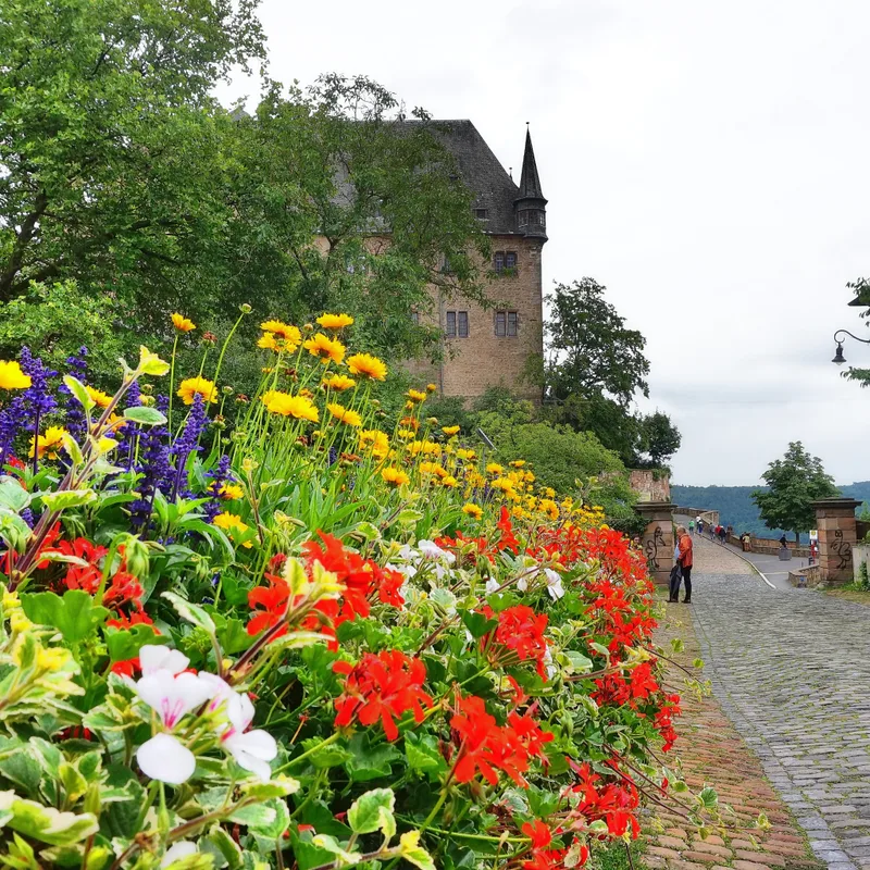
From the idyllic half-timbered village of Fronhausen, the Lahnwanderweg leads over fields and meadows, passes charming Hessian villages, and delights with splendid distant views. The Marburg castle is a real highlight at the end, and in one of the numerous cozy establishments in the old town, you can beautifully round off the day.

24.1 km approx. 7:15 h Point-to-point Hiking
View details
Ascent
426 m
Descent
402 m
Elevation profile 165–338 m
250 m 500 m
180 m 9.2 km 182 m 15 km 338 m 20 km 0 km 25 km
Source: (c) das Lahntal / Jörg Thamer · CC BY-SA 4.0 Open route description (external link)

Stage 8

08. Etappe von Fronhausen nach Lollar über Salzböden und Ruttershausen

5.6 km approx. 1:45 h Point-to-point Hiking
View details
Ascent
106 m
Descent
99 m
Elevation profile
250 m 500 m
3.3 km 0 km 5.6 km

Elevation profile calculated by Fairvisit from satellite elevation data. Ascent and descent usually differ by up to about 10 %, more on steep terrain.

Source: OpenStreetMap contributors · ODbL

Ortsmitte → Bahnhof

Stage 8

Today is a truly relaxed hiking day. First, we climb the Altenberg, which dominates the landscape at 299 m. It's good that there are benches at the top to rest. Then it goes through the romantic Salzbödetal at the edge of the Krofdorfer Forest. The Salzbödetal was already described by Rilke in 1905 as particularly scenic.

11.9 km approx. 3:45 h Point-to-point Hiking
View details
Ascent
215 m
Descent
205 m
Elevation profile 162–275 m
250 m 500 m
275 m 4.2 km 261 m 9.5 km 0 km 12 km
Source: (c) das Lahntal / Jörg Thamer · CC BY-SA 4.0 Open route description (external link)

Zentrum → Ortsmitte

Stage 9

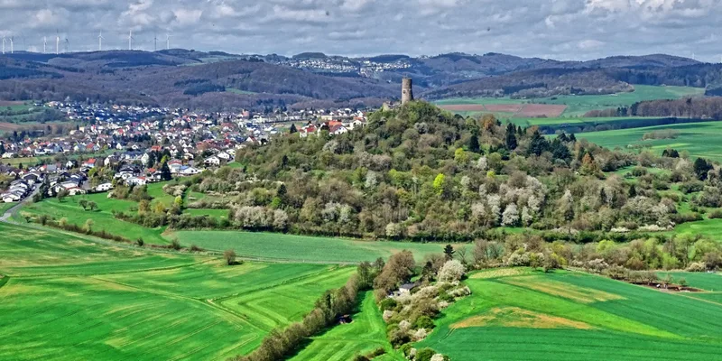
We start in Rodheim-Bieber at the church. Right at the beginning of the stage, damsels and lords of the castle fully enjoy the detours to the castle ruins Vetzberg and Gleiberg. According to an old legend, there is supposed to be a secret passage between the two castles  but beware, it is not marked with the Lahnwanderweg logo. Make sure to climb the towers of the castles Vetzberg and Gleiberg! Both offer breathtaking views. Afterwards, we hike through the idyllic Wi24marbachtal before going up into the mixed forest. Here we leave the Lahnwanderweg and stroll down to the stage destination in Lollar. Alternative start in Gie23en: The [Gie23en access route](https://www.outdooractive.com/r/6080162/) to the Lahnwanderweg leads 7.2 km across the Lahn meadows to the Lahnwanderweg in Krofdorf-Gleiberg. From there you reach Lollar in another 15.6 km on the Lahnwanderweg, where [LAWA stage 8](https://www.outdooractive.com/r/27427370/) connects to the north. Alternative destination for stage 9 Alternatively, you can end the stage via the [Gie23en access route](https://www.outdooractive.com/r/6080162/) to the Lahnwanderweg also in Gie23en, resulting in a total distance of 12.3 km. **\*\*\* Current note: Due to renovation work, the tower of the Vetzberg castle ruins is currently not climbable until further notice! **

21.4 km approx. 6:45 h Point-to-point Hiking
View details
Ascent
368 m
Descent
403 m
Elevation profile 162–323 m
250 m 500 m
174 m 6.6 km 323 m 15 km 0 km 21 km
Source: (c) das Lahntal / Jörg Thamer · CC BY-SA 4.0 Open route description (external link)

Dom (35578 Wetzlar) → Zentrum

Stage 10

Today it goes up and down. First, we leave the romantic town of Wetzlar and ascend through the idyllic Ilmenau park to the Garbenheimer Watchtower. From the Bismarck Tower (currently unfortunately closed), we can once again take a look back and enjoy the path ahead of us. Through the Lahn meadows, we walk very leisurely, visit the Roman forum in Waldgirmes, and stroll through the magnificent deciduous forest to Rodheim-Bieber.

16.4 km approx. 4:45 h Point-to-point Hiking
View details
Ascent
332 m
Descent
298 m
Elevation profile 149–334 m
250 m 500 m
149 m 4.4 km 264 m 10 km 0 km 16 km
Source: (c) das Lahntal / Jörg Thamer · CC BY-SA 4.0 Open route description (external link)

Marktplatz → Eisenmarkt (35578 Wetzlar)

Stage 11

History and stories shape today's stage. It starts in Braunfels with its fairytale castle, old town, and the Herren garden. In the FFH and bird protection area Weinberg, nature and landscape lovers get their money’s worth. The protected area is home to many rare animal and plant species and is still grazed by sheep as in the past. Three to four times a year, a shepherd with more than 800 animals moves over the meadows. The Kalsmunt castle ruin once protected Wetzlar and the "Hohe Straße", a formerly very important trade route from Cologne to Frankfurt. From there, it goes down to Wetzlar with its picturesque old town.

13.0 km approx. 4:15 h Point-to-point Hiking
View details
Ascent
166 m
Descent
242 m
Elevation profile 150–291 m
250 m 500 m
291 m 6.0 km 0 km 13 km
Source: (c) das Lahntal / Jörg Thamer · CC BY-SA 4.0 Open route description (external link)

Zentrum → Marktplatz

Stage 12

Today, the Lahnwanderweg presents itself particularly varied. The section offers geological and cultural highlights. First, you pass Weilburg Castle with its impressive garden. Kubach Crystal Cave offers a special geological spectacle. It is the only crystal cave in Germany and has, at 30 meters, the highest hall of all German show caves. The animal park, established in 1590 under Prince Karl August, is now used as a wildlife park. The year-round constant 12-degree warm "Große Weiher" near Braunfels hosts unique fauna and flora. Lastly, Braunfels also boasts a genuine fairytale castle. Those who have the choice...

17.9 km approx. 6:15 h Point-to-point Hiking
View details
Ascent
332 m
Descent
243 m
Elevation profile 149–309 m
250 m 500 m
157 m 3.8 km 309 m 11 km 0 km 18 km
Source: (c) das Lahntal / Jörg Thamer · CC BY-SA 4.0 Open route description (external link)

From Ortsmitte

Stage 13

On this section of the Lahnwanderweg, the hiker enjoys pure tranquility. With views of the Feldberg, the former mining village Falkenbach, and the Ernst-Dienstbach footbridge, originally built as a wooden water conduit bridge in 1706, there are still real highlights. The most beautiful view is from the Feldberg viewpoint. The Großer Feldberg can be seen clearly in good weather.

19.5 km approx. 6:15 h Point-to-point Hiking
View details
Ascent
393 m
Descent
353 m
Elevation profile 120–304 m
250 m 500 m
231 m 6.0 km 304 m 12 km 0 km 19 km
Source: (c) das Lahntal / Jörg Thamer · CC BY-SA 4.0 Open route description (external link)

Bahnhof → Lahnbrücke

Stage 14

Today we start at the source of Lahn marble. It can be found in many famous buildings, such as the baroque marble bath of Weilburg Castle – conveniently nearby and on the route. But Lahn marble was even used in the Hermitage in St. Petersburg and in the entrance hall of the Empire State Building in New York! After visiting the Lahn Marble Museum and the Unica marble quarry, there is still plenty of time for this scenic route. Between Villmar and Aumenau, the lonely meadows and forest sections high above the Lahn are enchanting. Steimelskopf offers views of the Taunus and even the Rheingau in good weather. Then it goes leisurely down along the Lahn to Aumenau.

12.7 km approx. 4:15 h Point-to-point Hiking
View details
Ascent
166 m
Descent
165 m
Elevation profile 117–238 m
250 m 500 m
238 m 6.0 km 0 km 13 km
Source: (c) das Lahntal / Jörg Thamer · CC BY-SA 4.0 Open route description (external link)

From Bahnhof

Stage 15

A highlight awaits the hiker right at the beginning. The old town of Limburg from the 12th century is almost completely preserved. On a rock with seven towers stands the landmark of the city - the Limburg Cathedral. Even if it is hard to leave Limburg: it's worth it! Runkel with its massive castle complex above the lock and the old bridge is fascinating. It is also particularly beautiful above the Wehrley nature reserve. The "Wehrley" has been a nature reserve since 1978. And to finish, the Lahn Marble Museum in Villmar. Hiking heart, what more do you want?

13.4 km approx. 4:45 h Point-to-point Hiking
View details
Ascent
159 m
Descent
148 m
Elevation profile 108–166 m
250 m 500 m
164 m 6.3 km 114 m 9.3 km 0 km 13 km
Source: (c) das Lahntal / Jörg Thamer · CC BY-SA 4.0 Open route description (external link)

Zentrum → Hauptbahnhof

Stage 16

In Balduinstein, with its beautiful Lahn promenade and castle ruins, one likes to stay. But the farewell is richly rewarded. Fachingen is especially known for the water of the same name. With a 26% market share, it is Germany's most important healing water source. The Grafenschloss Diez high above the Lahn and the town itself invite you to linger. Viewpoints like the Katzenkopp and Franzosenley line the way. And the beautiful town of Limburg is a worthwhile destination of this hike.

14.1 km approx. 4:15 h Point-to-point Hiking
View details
Ascent
329 m
Descent
328 m
Elevation profile 104–214 m
250 m 500 m
104 m 4.3 km 106 m 7.5 km 108 m 10 km 0 km 14 km
Source: (c) das Lahntal / Jörg Thamer · CC BY-SA 4.0 Open route description (external link)

Lahnbrücke → Zentrum

Stage 17

Forest and wine, sporty ascents and descents, wonderful views such as Goethe point, Wolfslei or Gabelstein, lonely valley cuts. Castles rise high above the slope in Balduinstein and Laurenburg – hiking heart, what more do you want? The stage is quite sporty, as several climbs await. So reduce speed and go slowly. Over rocks, partly secured with cables, you climb along a ridge. A head for heights and sure-footedness are necessary, but there is also an easy (without climbing) alternative.

19.3 km approx. 6:45 h Point-to-point Hiking
View details
Ascent
798 m
Descent
774 m
Elevation profile 88–292 m
250 m 500 m
180 m 5.5 km 93 m 9.7 km 241 m 14 km 0 km 19 km
Source: (c) das Lahntal / Jörg Thamer · CC BY-SA 4.0 Open route description (external link)

Kurhaus → Lahnbrücke

Stage 18

The route continues multifacetedly up the Lahn. Especially lovers of views and culture will be thrilled by this stage. Whether Nassau Castle, the Leaning Tower of Dausenau, a winged altar from the 15th century, or the second oldest half-timbered town hall in Germany – the day is actually too short to see everything. Nice dining options in Nassau ensure physical well-being. On the Concordia Tower, the Hohe Lay, or at the Kuxlay, "viewers" get their money's worth. A real route of superlatives – it should be mentioned that about 750 meters of elevation are managed. You can then treat yourself to a hearty Lahn wine in one of the cozy wine taverns in Obernhof. So plan enough time to enjoy everything.

19.3 km approx. 7:15 h Point-to-point Hiking
View details
Ascent
751 m
Descent
710 m
Elevation profile 77–340 m
250 m 500 m
340 m 6.8 km 84 m 11 km 0 km 19 km
Source: (c) das Lahntal / Jörg Thamer · CC BY-SA 4.0 Open route description (external link)

Bahnhof Niederlahnstein → Bahnhof Bad Ems

Stage 19

The start! Right at the beginning, the full variety of the path reveals itself: tranquil, spectacular, romantically wild, scenic and relaxing. Where the Lahn must flow into the Rhine, an exciting hike begins. In Niederlahnstein, it is still very peaceful on the banks of the Rhine and Lahn. Then it becomes spectacular and romantically wild on the partly rope-secured path through the Ruppertsklamm gorge. Pure relaxation and tranquility can be found in magnificent beech forests and at viewpoints high above the Lahn. The stage ends in Bad Ems, interesting historically and in a sophisticated atmosphere. Hiking in the Realm of Facets!

16.4 km approx. 5:15 h Point-to-point Hiking
View details
Ascent
395 m
Descent
389 m
Elevation profile 61–289 m
250 m 500 m
289 m 8.2 km 82 m 13 km 0 km 16 km
Source: OpenStreetMap contributors · ODbL Open route description (external link)

Elevation data

produced using Copernicus WorldDEM-30 © DLR e.V. 2010-2014 and © Airbus Defence and Space GmbH 2014-2018 provided under COPERNICUS by the European Union and ESA; all rights reserved

The organisations in charge of the Copernicus programme by law or by delegation do not incur any liability for any use of the Copernicus WorldDEM-30.

Saved