Skip to content

Long-distance trail

Kammweg Erzgebirge-Vogtland

About 289 km hiking trail from Geising along the Ore Mountains ridge and through the Vogtland to Blankenstein in Thuringia, in 17 stages.

Stages
17
Total distance
about 289 km

The map shows the whole trail. So far 5 of the 17 stages are described individually; the trail operator has not published the others openly.

Stages

Start Finish

Muehlleithen → IFA Ferienpark

Stage 13

As an alternative route or additional day tour between Morgenröthe-Rautenkranz and Mühlleithen (stage 12 / 13), a detour via the Aschberg in Klingenthal is recommended: [https://www.vogtland-tourismus.de/de/tour/wanderung/tagestour-kammweg-27-rundweg-aschberg/809492914/](https://www.vogtland-tourismus.de/de/tour/wanderung/tagestour-kammweg-27-rundweg-aschberg/809492914/)

15.1 km approx. 4:15 h Point-to-point Hiking
View details
Ascent
134 m
Descent
216 m
Highest point
907 m
Lowest point
700 m
Elevation profile
600 m 800 m
9.0 km 0 km 15 km

Elevation profile calculated by Fairvisit from satellite elevation data. Ascent and descent usually differ by up to about 10 %, more on steep terrain.

Source: Birgit Knöbel · CC BY-SA 4.0
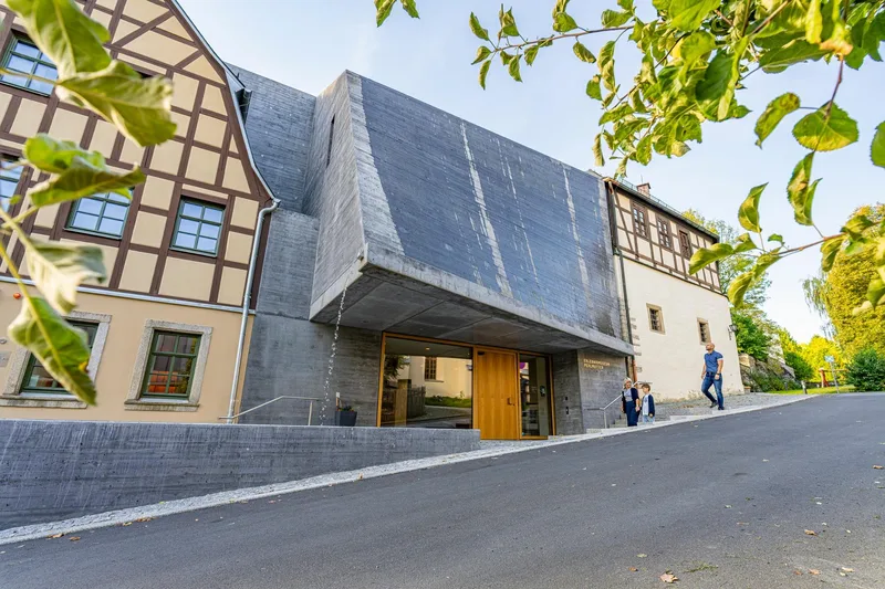
Schoeneck IFA Ferienpark → Obereichigt Bushaltestelle

Stage 14

Shortly before Adorf, the ridge trail splits into two variants. The official route leads on natural paths, partly with beautiful wide views, around Adorf. The variant described here is signed as an "Alternative" cultural route that leads directly through the town of Adorf, where a visit to the Perlmutter Adventure Museum, reopening in September 2025, or a detour to the botanical garden and the miniature exhibition "Little Vogtland" is worthwhile.

21.9 km approx. 6:30 h Point-to-point Hiking
View details
Ascent
274 m
Descent
455 m
Highest point
767 m
Lowest point
442 m
Elevation profile
600 m 800 m
7.6 km 12 km 0 km 22 km

Elevation profile calculated by Fairvisit from satellite elevation data. Ascent and descent usually differ by up to about 10 %, more on steep terrain.

Source: Saskia Prelec · CC BY-SA 4.0

Bushaltestelle → Parkplatz Burgsteinhäuser

Stage 15

20.8 km approx. 6:00 h Point-to-point Hiking
View details
Ascent
287 m
Descent
346 m
Highest point
621 m
Lowest point
434 m
Elevation profile
600 m 800 m
5.8 km 15 km 0 km 21 km

Elevation profile calculated by Fairvisit from satellite elevation data. Ascent and descent usually differ by up to about 10 %, more on steep terrain.

Source: Tourismus Marketing Gesellschaft Sachsen mbH · CC BY-SA 4.0

Burgstein OT Krebes (Wanderparkplatz an den Burgsteinhaeusern) → Museum für Gerberei - und Stadtgeschichte

Stage 16

23.0 km approx. 6:45 h Point-to-point Hiking
View details
Ascent
325 m
Descent
403 m
Highest point
619 m
Lowest point
442 m
Elevation profile
600 m 800 m
13 km 0 km 23 km

Elevation profile calculated by Fairvisit from satellite elevation data. Ascent and descent usually differ by up to about 10 %, more on steep terrain.

Source: Tourismus Marketing Gesellschaft Sachsen mbH · CC BY-SA 4.0

Museum für Gerberei- und Stadtgeschichte → Selbitzplatz

Stage 17

13.8 km approx. 4:15 h Point-to-point Hiking
View details
Ascent
323 m
Descent
352 m
Highest point
517 m
Lowest point
416 m
Elevation profile
600 m 800 m
500 m 4.3 km 516 m 9.4 km 0 km 14 km

Elevation profile calculated by Fairvisit from official terrain data.

Source: Tourismusverband Vogtland · CC BY-SA 4.0

Elevation data

produced using Copernicus WorldDEM-30 © DLR e.V. 2010-2014 and © Airbus Defence and Space GmbH 2014-2018 provided under COPERNICUS by the European Union and ESA; all rights reserved

Datenquelle: Bayerische Vermessungsverwaltung – www.geodaten.bayern.de, CC BY 4.0

The organisations in charge of the Copernicus programme by law or by delegation do not incur any liability for any use of the Copernicus WorldDEM-30.

Saved