Westweg · Stage 12
Westweg Stage 12 (West): Kandern - Basel
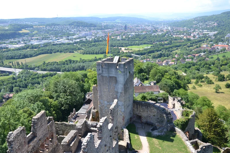
The Westweg winds its way through the lovely Markgräfler Land toward its destination in Basel. The wild and romantic Wolfschlucht gorge, magnificent beech forests, small vineyards, and the imposing ruins of Rötteln Castle lie along the route. Climbing over the scenic Tüllinger Berg, the Westweg descends to the little Wiese River. The route continues through surprisingly lush greenery into the Swiss metropolis at the bend in the Rhine, all the way to the Badischer Bahnhof in Basel. From Kandern, the Westweg initially follows the Kander Valley. On the slopes of the Kander, rocks have broken away to form the Wolfschlucht. Through narrow rock passages and steep slopes, narrow paths wind beneath the canopy of mighty beech trees—sometimes uphill, sometimes downhill—all the way to Hammerstein. The first vineyards accompany hikers through Egerten to the Baselblick Hut above Wollbach. Behind the picturesque little village in the Markgräflerland, the trail disappears into the forest and heads along the Flachslandweg toward the Rötteln castle ruins, which tower majestically over Lörrach. The castle, which was rebuilt to its current size after the Basel earthquake of 1356, is one of the largest castle complexes in southern Baden. The climb up the Staufer keep is well worth it—if only for the view over the castle, the town, and the Wiesental valley. The nearby church in Rötteln is also worth a visit. In this church, which is over 1,250 years old, the tombs of Margrave Rudolf III of Baden and his wife are located in a vaulted chapel. The trail winds through the tower rings up the Tüllinger Berg to the Daur Hut, which offers spectacular views. As you hike along the edge of the forest to the Tüllinger Höhe, new views of the Wiesental valley, the Dinkelberg, and the town of Lörrach constantly open up. A short while later, the terrace of the Ottilien Church in Obertüllingen offers a magnificent view of Basel. Passing through the Swiss vineyards, you’ll reach the small Wiese River. The Wiesedamms trail leads through the Langen Erlen to the zoo of the same name, from where it’s only a few minutes’ walk to the Badischer Bahnhof. PLEASE NOTE: Upon crossing the border into Switzerland, the Westweg trail markings align with the Swiss hiking trail markings. Please follow the Swiss diamond symbol all the way to the trail’s endpoint at the Badischer Bahnhof in Basel; the Westweg’s red diamond marking ends at the German border. Please also note that a section of the Westweg passes through the “Lange Erlen” Zoo in Basel. The park is open daily from 8:00 a.m. to 6:00 p.m. from March through October and from 8:00 a.m. to 5:00 p.m. from November through February, with free admission. Outside these hours, you must walk around the animal park.
- Length
- 26.2 km
- Walking time
- approx. 7:45 h
- Ascent
- 450 m
- Descent
- 541 m
Walking time as stated by the operator.
Elevation profile calculated by Fairvisit from satellite elevation data. Ascent and descent usually differ by up to about 10 %, more on steep terrain.
Start
Nearby
Along the way
Finish
Nearby